a.k.a Getting lost in the mid-West
The original plan was to travel by train to Salisbury on a Saturday morning followed by a leisurely meandering ride to Bath over two days. However a few days before the ride I realised that I’d planned the ride for the same weekend as the annual London to Brighton charity bike ride. This scuppered plans. Southern Trains, in their great wisdom, ban bikes on trains anywhere near Brighton on this day, despite telling me everything would be fine with a bike when I pre-booked my tickets. Grrr. A squizz at the map, a couple of re-bookings, and a new plan took form: Train to Bath, then 2 day ride back to Brighton via Cheddar and Salisbury. It meant more miles but it looked feasible, if a little daunting. However as Tourist Trophy instigator Jo Burt said, “Do something that scares you once in a while.” So, here is the tale of a two-day ramble…
Day 1
The day didn’t start well, due to a slight lack of planning and, more honestly, my own idiocy. The late change of plans meant I didn’t have all the right maps and was relying on route planner print outs, a couple of pages torn from an old AA road atlas, and one OS map for the area around Cheddar and Wells. Then I went with the ‘follow your nose’ option to get out of Bath, guessing south by the position of the sun. I was vaguely correct but headed southeast rather than southwest. Oh, and straight up a very steep hill towards Claverton Down and Combe Down.
At the summit I decided it would probably be better to check a map. I really should have brought the OS map of the Bath area with me (jetisoned from my small back pack the night before in interest of space), rather than trying to use the tiny maps on printouts. Anyway I matched a place name on a piece of paper with a signpost and headed southwest towards Tunley in sunshine. The arm warmers came off and sunblock went on. Thirty minutes later the arm warmers went back on. Fifteen minutes after that the waterproof went on.
I needed to head for Temple Cloud, easy to remember as this is the name of an old Sarah Records compilation album (Sarah 376, released 1990. Being listened to as I type this), but I missed a turning somewhere though and ended up in Clutton. Twice. Don’t ask. Asking the local butcher the way to West Harptree I was pointed towards Bishop Sutton and Chew Valley Lake. Then the heavens really opened. The sky turned that featureless monotonous grey that indicates that the rain may never stop. It was utterly miserable. I was cold and wet within seconds and my route notes turned to papier mache. I kept trying to memorise place names and junctions a few ahead so I wouldn’t get the map soaked. I even considered giving up and turning back for Bath and a warm, dry train home. But that is cheating.
As soon as I got to West Harptree I turned for East Harptree rather than passing straight through the village. A few miles down the road the rain stopped and I decided it might be time to refer to the map properly. I’d gone the wrong way again. Can you see the pattern forming here? To compound matters I had cold, wet feet (overshoes had also been jettisoned in favour of space. Don’t pack too light when starting out on long 2 day rides kids, it’s silly). Back on the right road I started to climb out of West Harptree to a junction where there was a sign for Cheddar. At least there was a hope of going the right way for a few miles!

A long steady climb over Harptree Hill was followed by long straight roads, old Roman roads, through open farmland on the high flatlands. Then after bend the landscape instantly changed. I was riding through a shallow valley, with rocky outcrops and stone walls. The valley sides steadily got steeper and more wooded as I reached the upper reaches of Cheddar Gorge. The sides of the gorge got higher and rockier until the steepening road twisted through the deep, dark chasm.


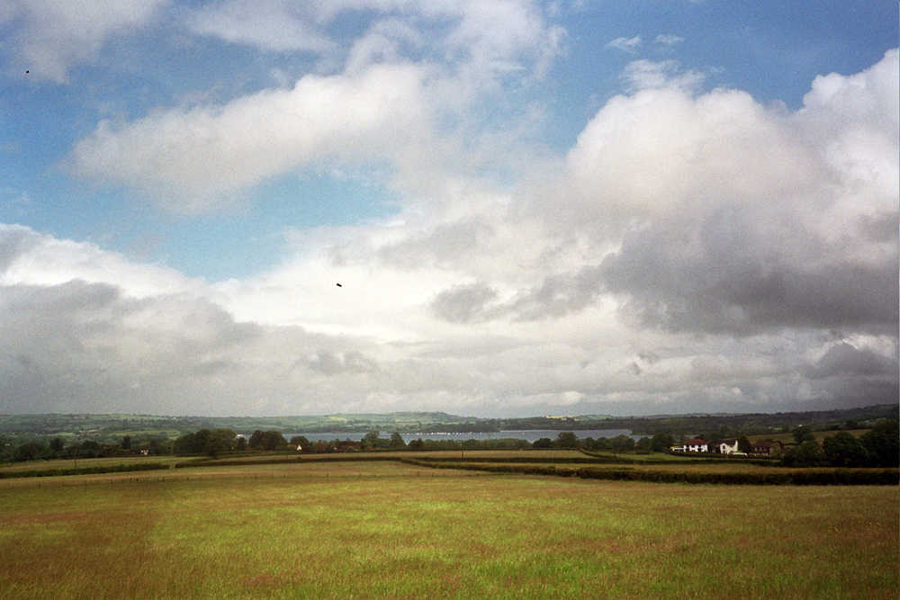
 Passing Cheddar village I turned east towards Wells catching a tailwind. The Mendip Hills spread away to the south and east, weird looking lumps, like children’s drawings of hills, with Glastonbury Tor clearly visible in the distance. The bells of St Cuthbert’s rang out for 3 as I rode through Wells, around the Cathedral and heading towards the Old Frome Road. Or I hoped I was, as no signposts seemed to match any names on my disintegrating route notes. Just as I started considering it might be as easy to write the day off, head for Frome and take my chances with the lorries on the A36 I spotted Cranmore on a signpost off to my right. Hurrah, this was the next road I was looking for!
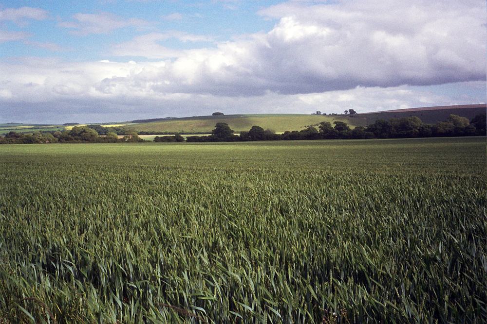
Miraculously, the sun started to really come out, so much so that I finally took my waterproof off. I found myself on tiny country lanes for the first time in the day which raised my mood considerably. In fact the next 20 miles were the best miles of the day, narrow lanes winding their way around steep hillsides and narrow valleys. I almost got caught as a farmer was herding his cattle across the road. Of course I missed another turning near Batcombe but I didn’t care so much. Strange how when the sun is shining and the roads are narrow and quiet getting lost is an adventure rather than a disaster waiting to happen.

 Back on course again I raced across the next junction with the Wiltshire Downs stretching ahead of me and a strong tailwind shoving me along. When I hit the A350 at the next junction I realised I’d gone the wrong way again! This meant one of two things; carry on and take the A36, or turn back and take the A350 south and pick up the road to Wilton as originally planned. I opted to turn back and head for Wilton.
 I’ve driven the Wilton road many times but I don’t remember it being quite so long or up and down. The sky ahead was grey but the sun and wind was behind me, leading to a beautiful silver-green shimmer of the underside of leaves against the clouds. Passing through Wilton a sign showed that Salisbury was 3 miles away, and not much further down the road I spotted the spire of Salisbury Cathedral framed between the trees. I’ve never been so happy to see the spire of any cathedral!
Strava link: http://www.strava.com/activities/60525192
Stats:
Miles ridden: 105
Feet climbed: 6300
Average speed: 15mph
Counties covered: 2 (Somerset & Wiltshire)
Number of times went wrong way: Too many
Bags of jelly babies consumed: 0.5
Emotional ups and downs: Too many
Lessons learned: One. Buy more maps.
Camera used: Olympus Trip 35
Film used: Out of date Kodak Gold 35mm

Leave a comment