The sun is rising into an otherwise empty sky as I ride out of Wadebridge across the bridge over the River Camel. This hundred metres or so will be the first and last flat part of today’s ride. The only other flat section is the ferry across the River Fowey at the southern most point of the journey and I didn’t ride that bit. Anyway the River Fowey is fifty miles away yet. There’s a good deal of riding to do before I get there.
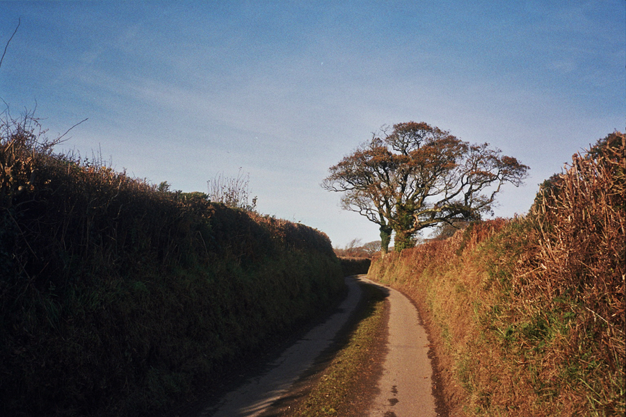
First off I’ve got to get over the granite backbone of the county, across Bodmin Moor. Both rivers I cross today rise on the moor, before flowing in opposite directions; one north to the Atlantic, the other south into the English Channel, both carving twisting valleys into the softer shales that surround the granite. I head east, up country towards Davidstow, through St Mabyn to St Tudy and on to Tuckingmill. I lose count of how many times the road rises and falls between these villages, the road is either going straight up or sharply down. The lanes are covered in gravel, mud, leaves, and sticks making climbing and descending all the more… er, interesting. Every time I get out of the saddle the back wheel spins and slips. Downhill I have to pick my line really carefully and dare not touch the front brake, and because it’s too dangerous to whizz down the hills I have no momentum to carry into the next uphill. So it’s back out of the saddle and the wheel starts slipping again. And repeat. Again and again. The strength is slowly sapped from my legs. I’m almost starting to regret the 40 mile warm up ride along the north coast to Tintagel that I did yesterday.
 So far the ride has been through hedge lined farmland, and woodland, but the climb from Tuckingmill takes me over a cattlegrid (the first of many!) onto the moor. The trees thin and disappear, a vibrant carpet of green stretches ahead of me under the brilliant blue sky. The granite lumps of Rough Tor poke up from the moor ahead of me. Now I’m out of out of the sheltered lanes and up in the open the north westerly wind is hitting me head on. However I know that once I get across this stretch of the moor to Davidstow airfield I’ll turn south out of wind. As I turn south I also find that I’m heading downhill for a good few miles until I pass under the A30.

 As soon as I’ve dipped under the A30 the road starts to climb again through North Hill and Henwood. The moor has a different character here. The lower lanes are again enclosed by high hedges, or ramp up through overhanging trees. As the landscape becomes more and more exposed the higher I get, but it’s more scrubby and scruffy here, there are small gnarly trees, crumbling moss covered stone walls and rocks. I wonder if all this climbing is playing tricks on me as some of the boulders appear to be moving. Then I realise they are grubby sheep grazing amongst the trees. Further on they just stand in the road and stare at me. I pass through Minions and the whole of south Cornwall spreads in front of me. I know the next few miles are predominantly downhill so I get my head down to make up some time.
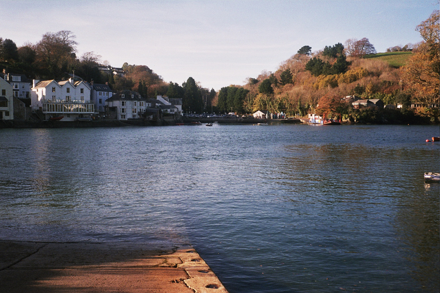
 Crossing over the A38 I head off my map, and my route notes turn out to be a bit too vague. “First left out of East Taphouse”. Turns out I meant the first left AFTER East Taphouse. As beautiful as the lane that is the first left turns out to be I’m not sure it’s the right road. It’s not, it goes to Herodsfoot and I’m supposed to be heading for Lerryn. Fortunately it’s a beautiful day, the sun is shining hard, and it’s the middle of the day so I know which way is south. So I follow the sun until I find a bigger road and signpost with a recognisable name on it – Looe. I know I don’t want to go here, but it’s in the right general direction, and hopefully somewhere I do want to go will be signposted off it. I’m also boosted by the fact I can see the sea and a lump of land sticking out into it that I am sure is Gribbin Head. It only takes a couple miles before I hit a junction with the road to the ferry across River Fowey. The next few miles gently roll down to the sea so again it’s head down to make up some time. At Bodinnick the ferry is across the the river. Time for a banana and a few minutes rest.
 A few minutes later I roll off the ferry. And straight back into the hills. I loop around the village of Fowey before heading out towards Bodmin. Crossing over the A390 to Lanlivery Puddle and the Crift Downs, I hit yet more steep slippery ups and downs before passing under the A30 for the second time today. More climbing and more descending follows before the brief respite of a valley road along a tributary stream in to the Camel. The respite doesn’t last long. The next few miles are harder than I want them to be at this stage in the day. There’s a sharp climb out of Brocton, I’m out of the saddle pushing over a low gear as I emerge from the valley shadow back into the sun. After a wiggle along a narrow lane lined with high, high hedges I see a 28% sign. Fortunately it’s downhill. Actually I don’t mean fortunately, it’s bloody terrifying. It starts steep but then the road just seems to drop away. I stop and look down the hill and am not convinced I want to go down there. However it’s too steep to turn around and climb back up. There’s no way I can walk down in cleats either. So I shift fowards onto the top tube, grab both brakes until my hands hurt, unclip a foot which then hovers just above the tarmac, and I proceed as slowly as gravity will allow. I reach the bottom safely but can smell warm aluminum. I check to see if I have any brake pads left. (The general reaction from aunt, uncle and cousins when I get back is “You rode down there!!?”)
I clip back in and start the final climb of the day, which fortunately isn’t as severe as what I just came down, but is steep enough to warrant a swear word or two. Once over this the last few miles are all downhill. The road is wide and bends shallow enough to see what’s coming so I scream back down into Wadebridge for a well earned cuppa and sarnie.
Thanks to Auntie Val, Uncle Stu, Jo, Greg, Isla, Sam, Denny, John, Angie, Charlie and Alice.
Strava link: http://www.strava.com/activities/97857320
Ride Stats
Miles ridden: 72.5
Feet climbed: 5800
Average speed: 12.1 mph (it was stupidly hilly & I took too many photos)
Hills climbed: I lost count
Ferries taken: 1
Camera used: Olympus Trip 35
Local ale consumed: St Austen Brewey Tribute, Sharpe’s Doom Bar

Leave a comment