 It has three names – Litlington Road, Chapel Hill and The Street (either side of Chapel Hill) – but is one continuous strip of tarmac. Running along the Cuckmere River valley from the Seven Sister visitor centre at Exceat to Wilmington, it transfers your ride from where the South Downs meet the sea inland to the Low Weald: A gap in the hills, atween the cliffs and the flatlands. Perhaps it should be ridden north to south, from the heart of Sussex to the edge of England, after all Exceat is derived from old English for exit.
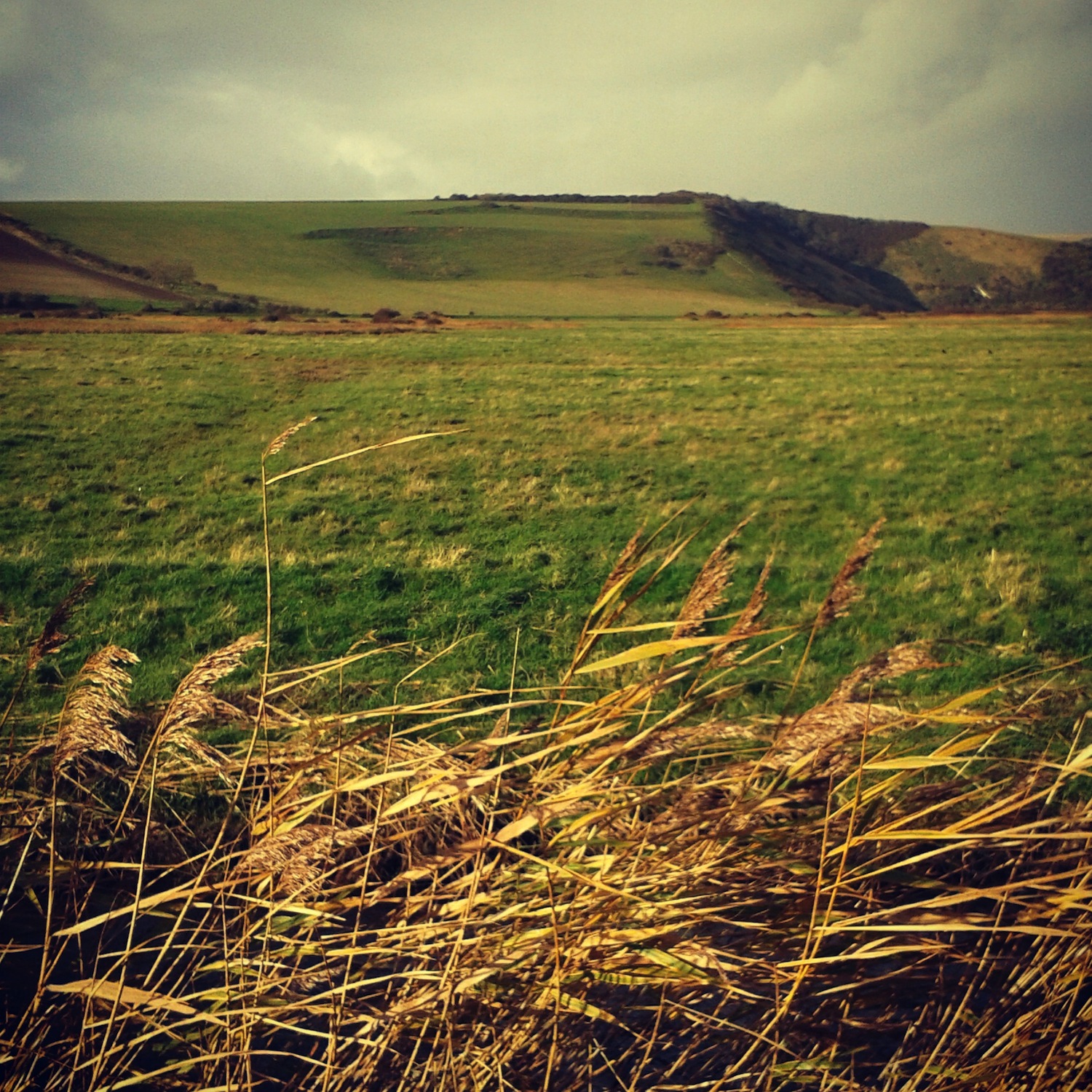
 Starting from the south, the direction I’ve ridden it most, the road marks the boundary of Friston Forest and the Cuckmere flood plain. A faint echo of Pevensey Levels on your left over the flood plain, a reed-lined stream edges the road and drainage ditches crisscross the valley floor. On your right side Friston Forest regales you in all its verdant glory, smothering the hills in summer, paths tacking off under the canopy. In autumn the russets and golds give way to brown falling leaves slowly revealing the latent image of the hillside.
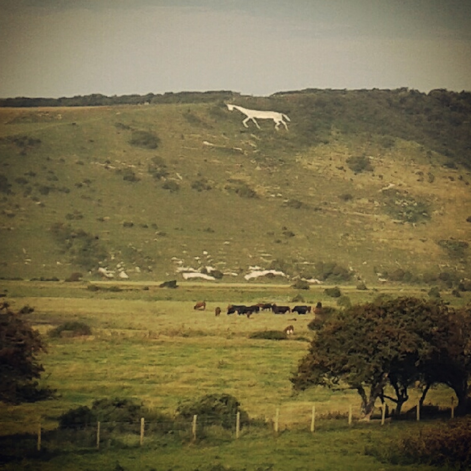
 On the far side of the valley the South Downs rise again over Hindover Hill, or High And Over depending on the age of your map. A white horse was cut into the chalk of the hill but you won’t see it clearly until you’re farther along the road. The road twists and turns skirting the edge of the valley, the surface rough. The back wheel will skip about as you dance on the pedals through the rising bends. In and out of trees and the landscape opens briefly and the White Horse is clearly visible in profile across the valley.
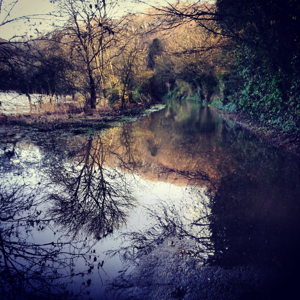
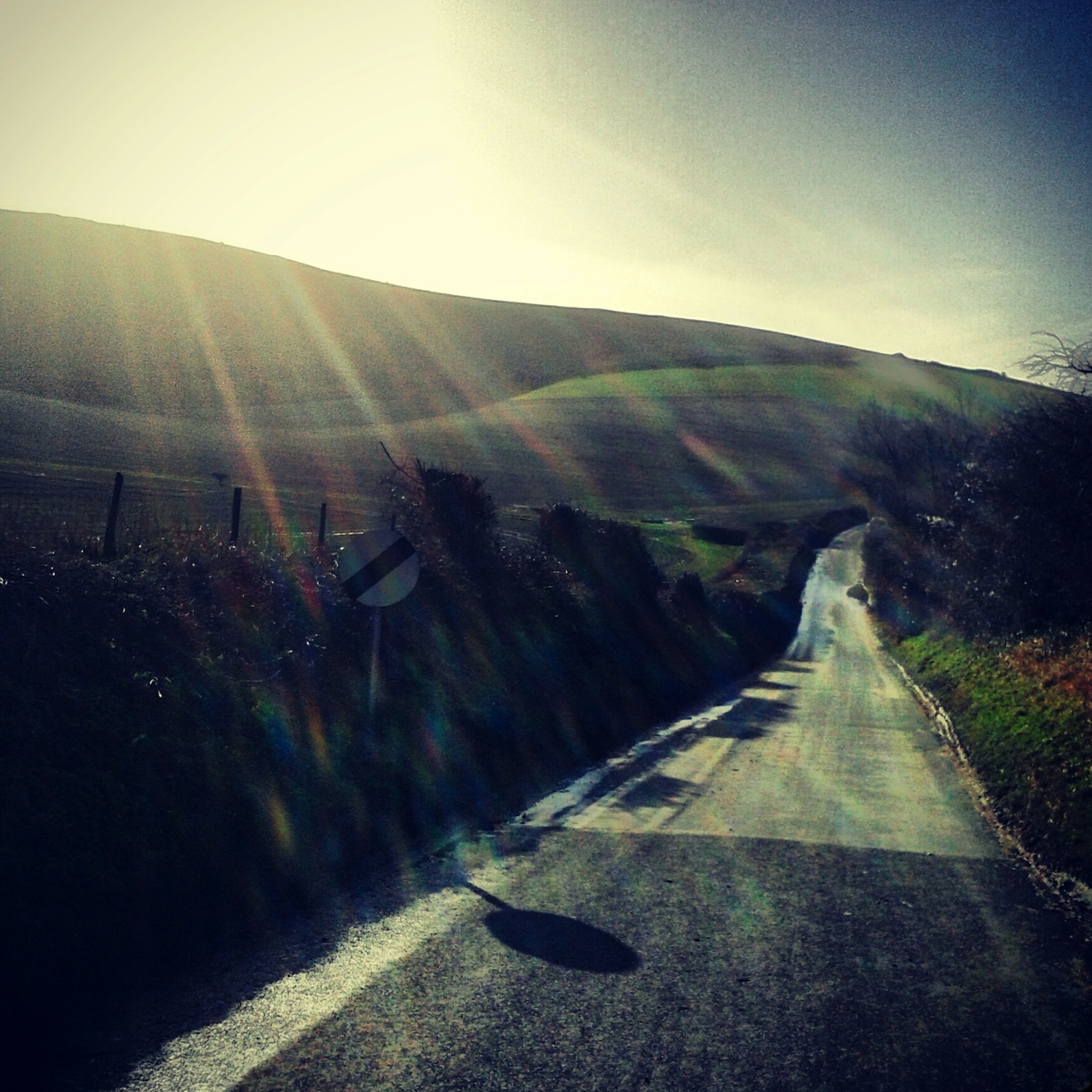
 The road gradually moves away from the river and undulates more and more, the middle section sunk into the earth hinting at a past as a drove road, centuries of hooves and feet wearing away the land. The valley side of the road is lined with trees, hiding the view in summer except for glimpses caught here and there. As the trees drop their leaves during autumn Alfriston becomes visible sitting next to the river. Last winter the spire of the Church of St. Andrew, the Cathedral of the Downs, appeared to rise from the river itself as the flood plain did exactly what its name suggests.
 Rising and dipping through a tunnel of trees the road curls into Litlington, a village made of flint and brick like many that nestle in the downs. There’s both a tea room and pub here but I’ve never partaken, mainly because across the valley is Alfriston and Badgers Tea Rooms, a favoured stop. Freewheeling out of Litlington you pass the Long Man brewery housed in flint barns before rising and falling yet again, dropping past Lullington Manor. If you want to stop off at Badgers in Alfriston (tea and toasted crumpets in the garden) turn left here: Follow the road around and over the Cuckmere, then turn left.
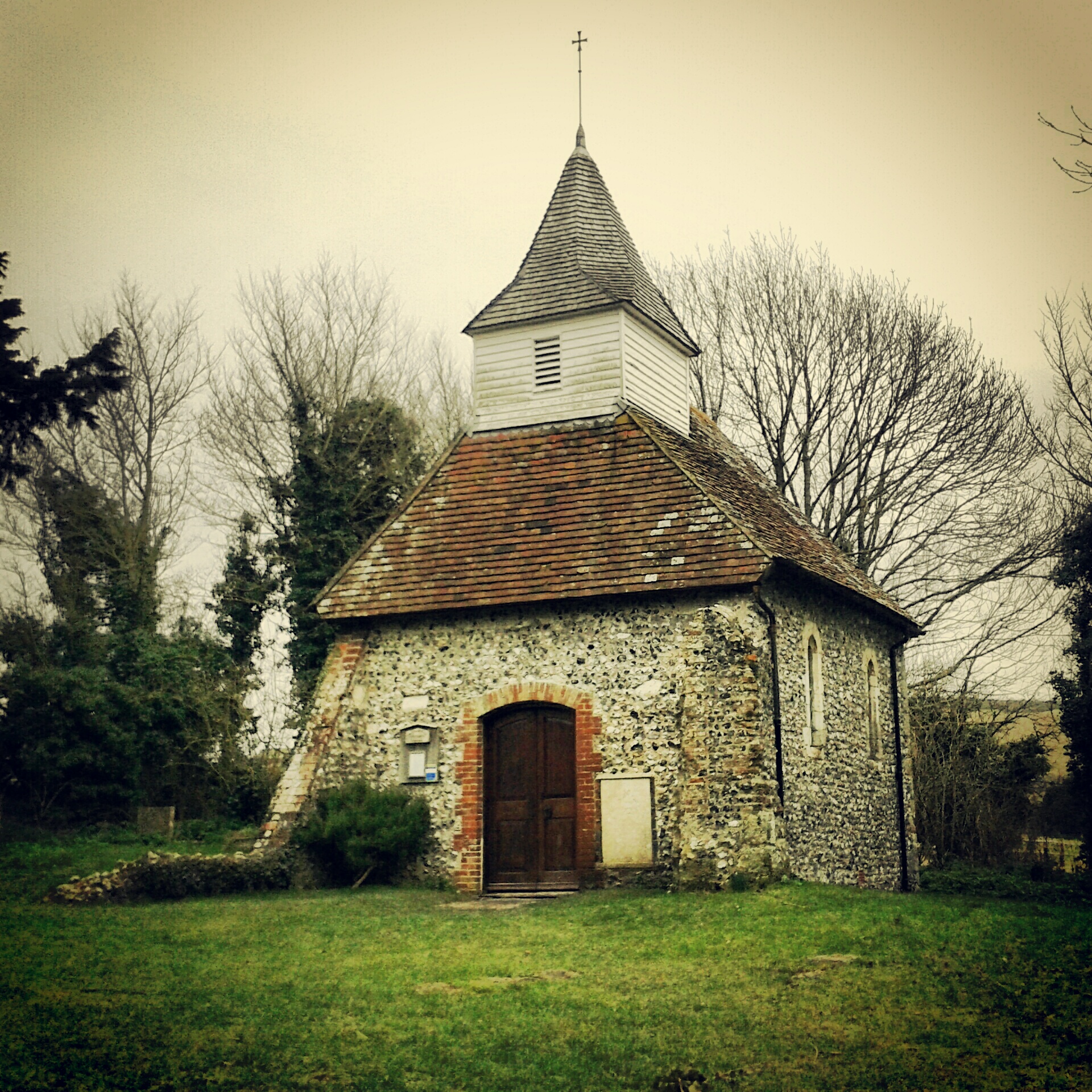
 The next few hundred yards up Chapel Hill will take some effort in a low gear or out of saddle. The South Downs sweep away to your right through the twin coombes of Ewe Dean and Park Bottom. A set of curves I can’t even begin to describe. You’ll just have to come and see for yourself. Arable patterns define the curves to perfection. The low winter sun the same. Half way up on the other side dart down what looks like someone’s garden path to see Lullington Church, or Church of the Good Shepherd, or the smallest church in Sussex http://www.youtube.com/watch?v=7M1hhm70DVQ
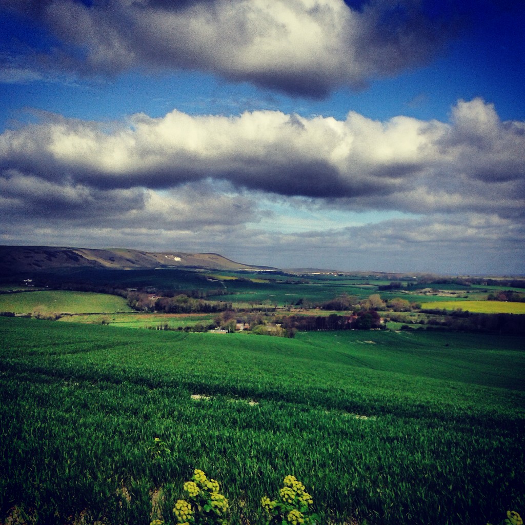
 Cresting the hill, where the South Downs Way crosses the road and up across Windover Hill, look west for probably my favourite view in the whole of Sussex. It isn’t the widest vista you’ll find, but the scale is perfect, enough to see for miles and miles, but small enough to know your way around it. Patterns of lines flow through the fields drawing your eye into the view. Whatever the colour and texture of these fields, it seeps into the distance. The South Downs always look good in profile, all soft ripples along the scarp edge. The white chalk path we just crossed stretches along that ridge before dropping into the next valley, that of the Ouse. You can see Bostal Hill, Bopeep chalk pit, the distinctive curve of Firle Beacon, the wind turbine at Glyndebourne, and Mount Cabon. Beyond that is home. On a clear day you can see north across the weald, past Arlington Reservoir, all the way to the North Downs.
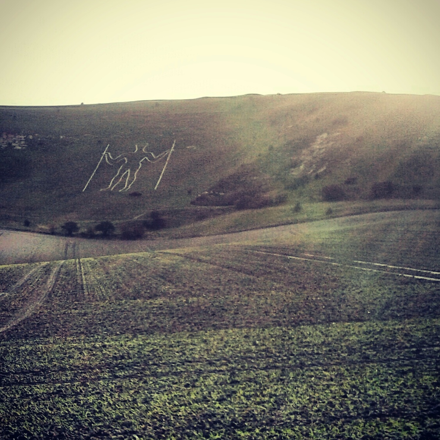
 From here roll down the road to the Wilmington Giant or more commonly the Long Man of Wilmington. Doff your cap to the Long Man, but he’ll just stand and stare back at you. He hides his story well. Neolithic, Iron Age, or 16th Century? Only he knows and he’s not telling. However or whenever he arrived, he’s made Sussex his home, and he’ll still be there long after I’m gone. In the snow he may recede from view, as he can when the grass is long, but he’s always there.
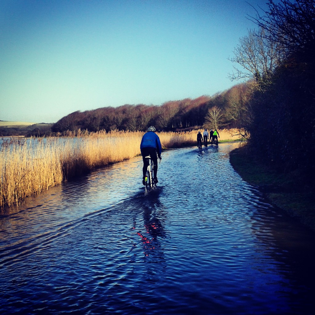
 Across the road stands what remain of Wilmington Priory, flint ruins as old as the Long Man? Maybe. The road narrows here as you enter the village, the sound of your freewheel reflects off the low flint walls as you whizz down towards the junction with the A27 past the Giant’s Rest. One day I’ll stop here for a pint. Once over the busy A27 you enter the flat lanes of the Low Weald. There are other things to be written about these lanes.


 First published by Nowhere Fast Cycle Club in November 2013

Leave a comment