I’ve written about mapping out rides before but plotting a route for the Transcontinental is bigger than any previous way finding I’ve needed to do by roughly a factor of ten. Both in terms of distance and the number of countries involved. I’ve been drawing a line across Europe. Superimposing a single simple line across many complicated interconnecting lines. Many lines have been drawn and redrawn across the continent throughout human history. Many kinds of lines have been marked across the landscape, some connecting, others separating, some natural, others man made. Many are weighed down by history, even though gone still visible in various ways. The line Jo and I will ride is invisible to all but us and we will traverse lightly, a tracing that will leave no trace other than in our memories. This isn’t strictly true as there’ll be dotwatchers following us and GPS recordings, but that is all just a digital simulacra that will be forgotten in the noise of the internet. This line will be our life for two weeks – we’ll follow it, eat on it, sleep on it, maybe change our minds about it, deviate from it, but we’ll always be close to it.
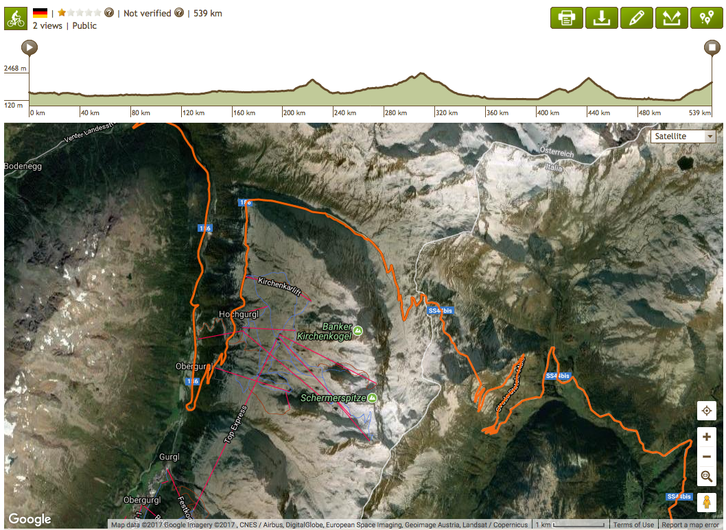
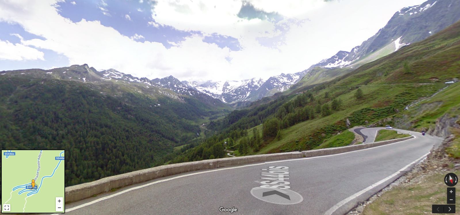
Two weeks of lunch hours, evenings, and weekends of looking and thinking. No prior knowledge, except for I rode up the Muur a couple of years ago. There’s no memory map to call upon this time. Information is gleaned from where ever it can be found; Paper maps, online routing tools, Streetview, Google Maps, satellite images, eavesdropping on Twitter conversations, searching for trans-European cyclepaths, checking (and double checking) the race manual. Checking the Foreign Office website for border controls and travel guidance. I think to myself I’m glad we’re doing this pre-Brexit – this could be a whole heap of hassle in a couple of years, but let’s not scratch the surface of that subject just yet (I’m sure there will be something else to write about being European after I’ve ridden across the continent). Lots of conversations about the pretty way versus the easier way have been had. We’re going the pretty way whenever possible. I don’t really see why you wouldn’t. This does mean I’ve routed us over the highest pass in the Eastern Alps, but oh heck it looks stunning. Anyway 20km of uphill will be followed by 20km of downhill…fast downhill. Sixty switchbacks I read. Then there’s the option of the easy valley road or climbing in and out of the Dolomites. Pretty vs. Easy, again.
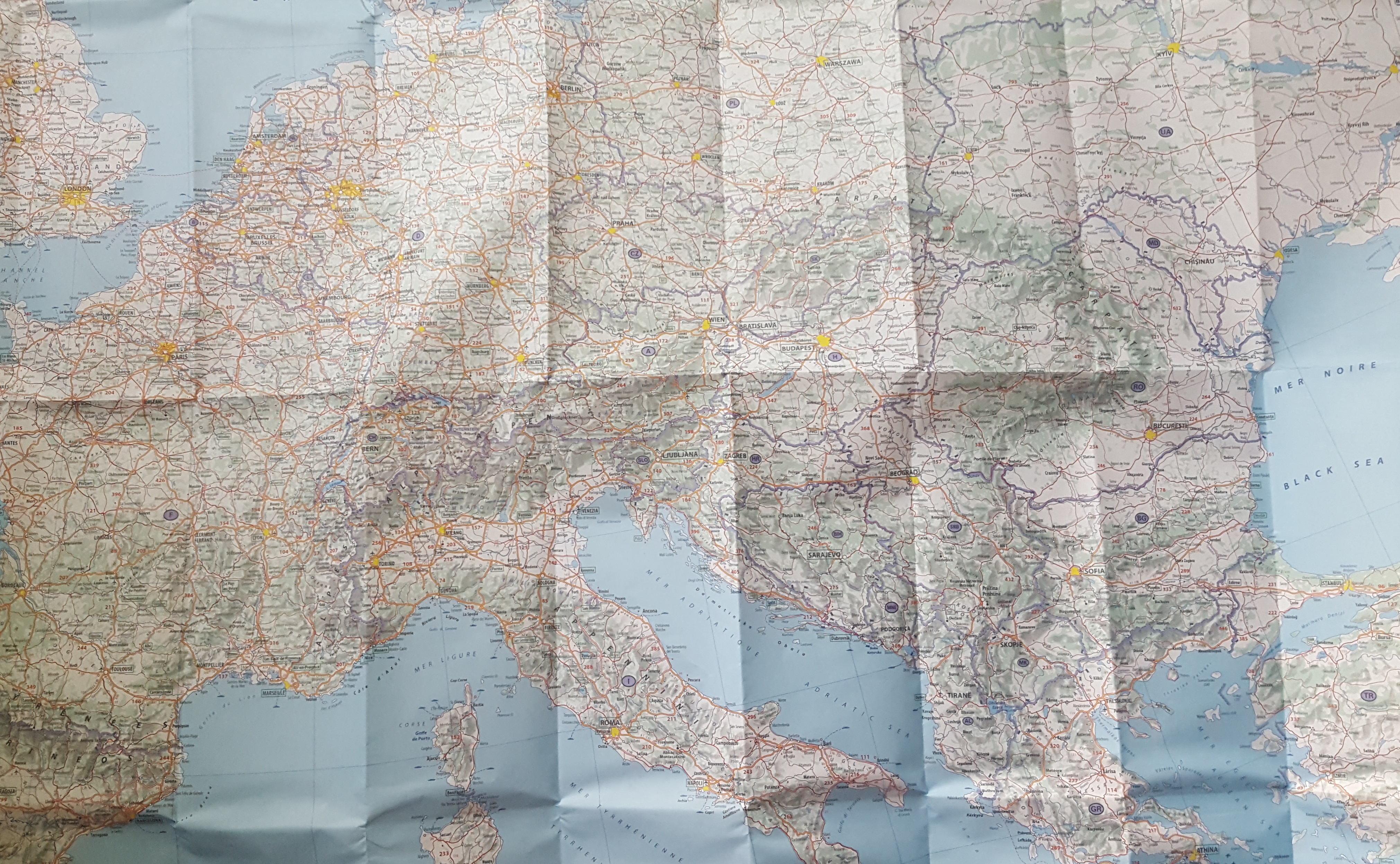
All of Europe has been unfolded and laid out across the floor to see how places link up and which of the multitude of ways between them are both the most feasible. Trying to make sense of something that isn’t entirely sensible. Figuring out road numbering systems (is that a motorway?) and factoring in border and river crossings, sometimes one and the same – the Rhine between France and Germany, the Danube between Romania and Bulgaria. Using paper maps for an overview, to see the lay of the land. Looking for ways across, between or around mountain ranges, finding the flat(ter) way, if there is one and as long as it doesn’t add too much distance. Tapping these thoughts into routing apps and tweaking almost ad infinitum. Avoiding one hill just to find a mountain. Forgetting to take scale into account when checking profiles – when the big pointy bit is significantly higher than 2000 metres then the chances are those other smaller pointy bits are still going to be over 2000 metres. Everything is scaling up.
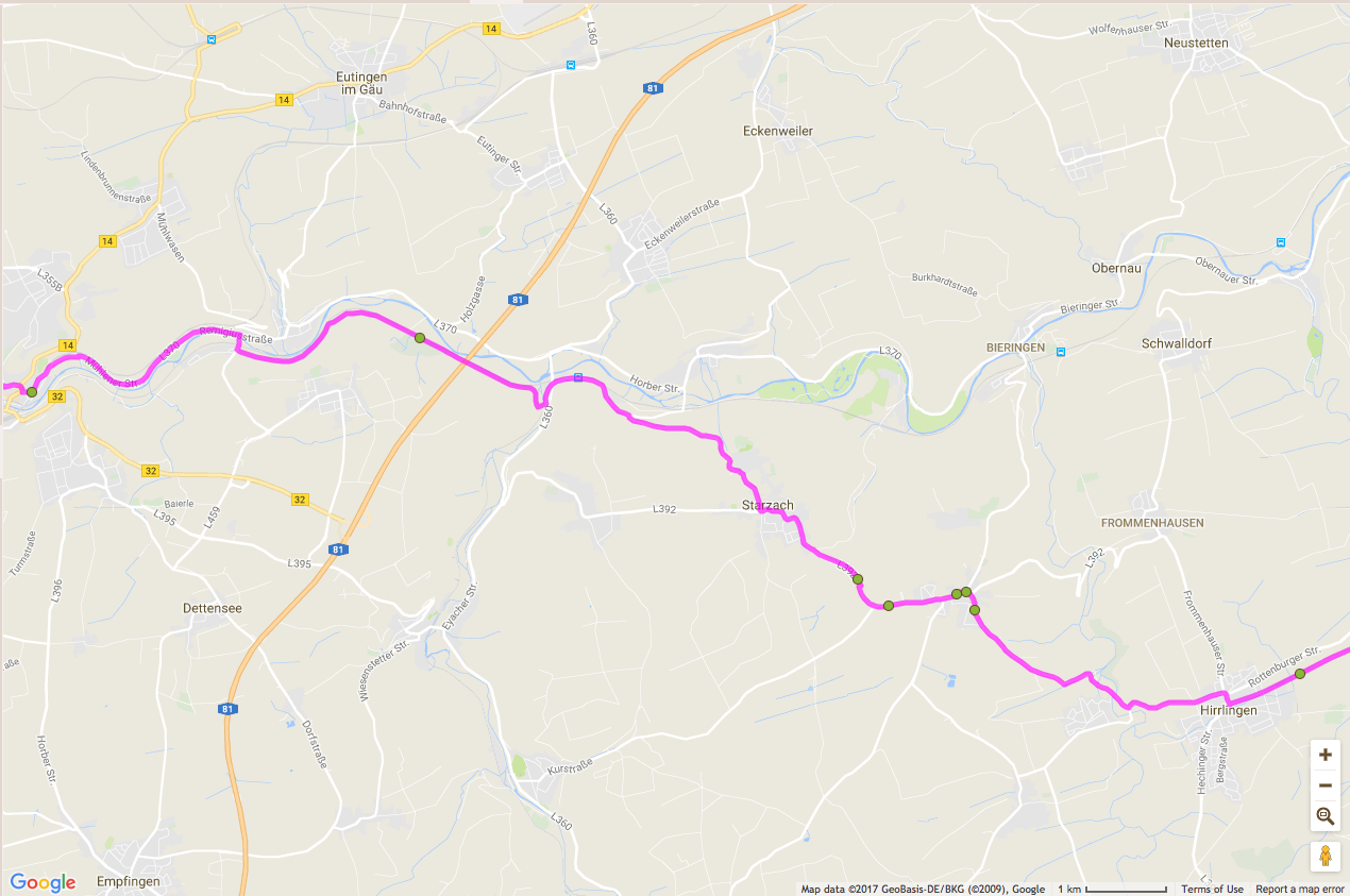
Additionally there is the need to know we can find food and water at regular intervals along the way and the task has been almost as time consuming as the ride will be. Deliberately routing us through the middle of towns to ensure we can find the things we need along the way. This isn’t my usual practice, I usually look for the smallest little roads that pass through nowhere, but experience tells me food and water can be hard to find following this pattern. I’ve been marking down Lidls and Tescos, McDonalds and Shell petrol stations. We want to soak in some of the culture and customs we ride through, take ourselves out of our comfort zones, live in the moment, experience the situation, that’s all part of the point of riding a bike, to be a part of what surrounds you, not separated and simply viewing. Yes these known quantities are easy, the recognisable amongst the unfamiliar, and as much as I don’t like the thought that these chains have leached across the world we’ll want, or more importantly need the convenience and ease of familiarity every now and again when exhausted and hungry. They are the nearest to a comfort zone we’re likely to get. My experience of Streetview is that the photos may be old and that little shop may no longer be there, but the big chains will be. As much as I want to support local economies sometimes I’m just going to want a big cup of coke whilst I upload to Instagram on the free wifi. Also big chains often means clean toilets.

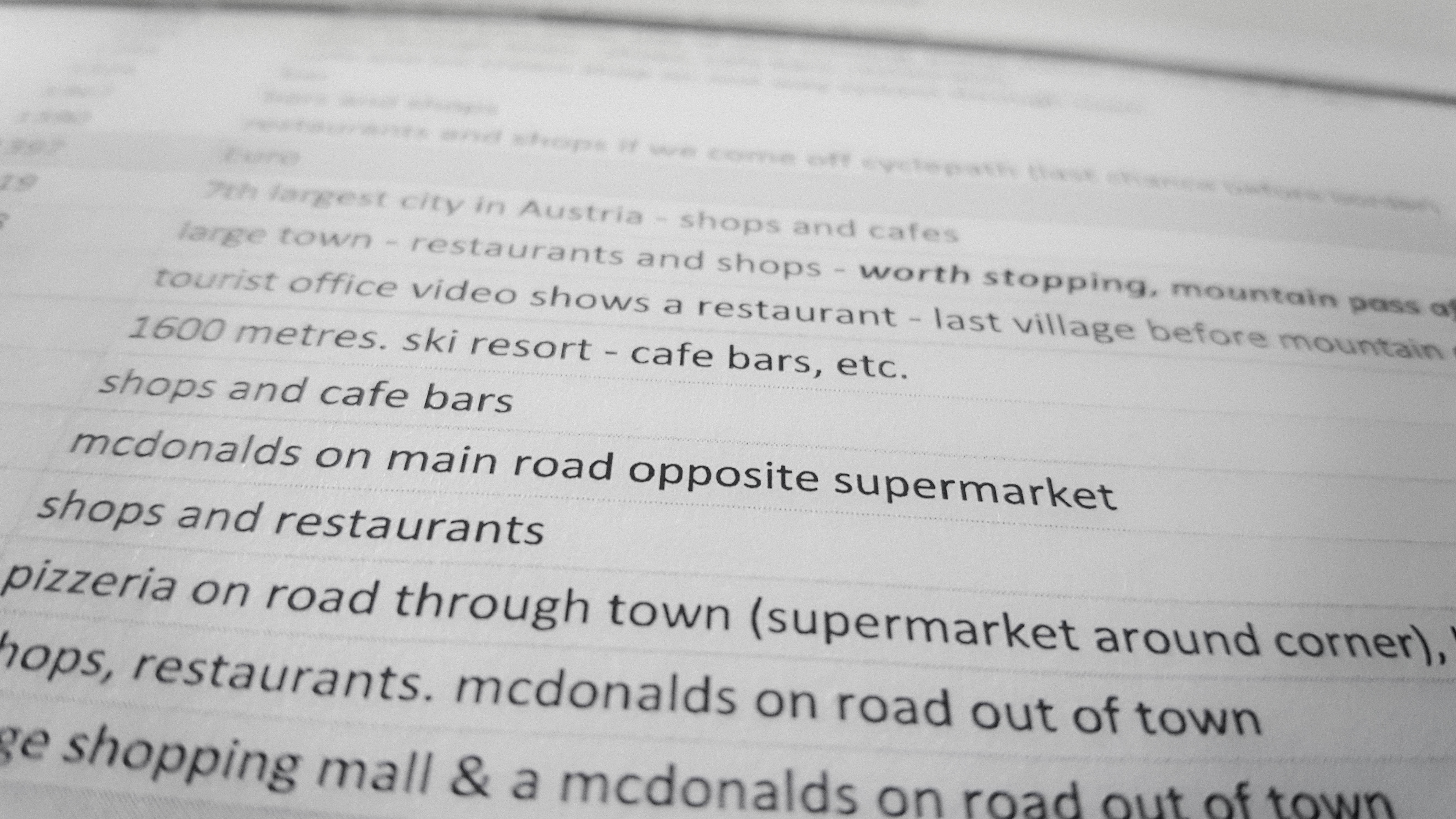
I don’t want to Streetview the entire route (not that there’s enough time for that) but there’s a trade off, a compromise between having some understanding of where we’re going and what’s in store for us, against the desire to leave things to be found and surprise us. We don’t want to find that that road turns into a dirt track through a forest on a Bulgarian mountain, that way lies difficulties and wolves, but it’s nice to know that there’s a little bar on that corner so we can get a coffee and fill up our water bottles. Also seeing the changes between regions and countries, and how things look more and more unfamiliar the further east and south we travel, only add to the anticipation. Finding place names lodged in my consciousness for reasons I can’t quite pin down – Graz, Bratislava, Sofia – but probably from sixties spy films. Perhaps from geography lessons back in school, but some places aren’t in the same countries as they were when I was a kid. Even in my lifetime the borders of Europe have been re-drawn. Other place names mean nothing now but in a few weeks will have taken on all kinds of significance. I’ve found places to go back to and explore at leisure.
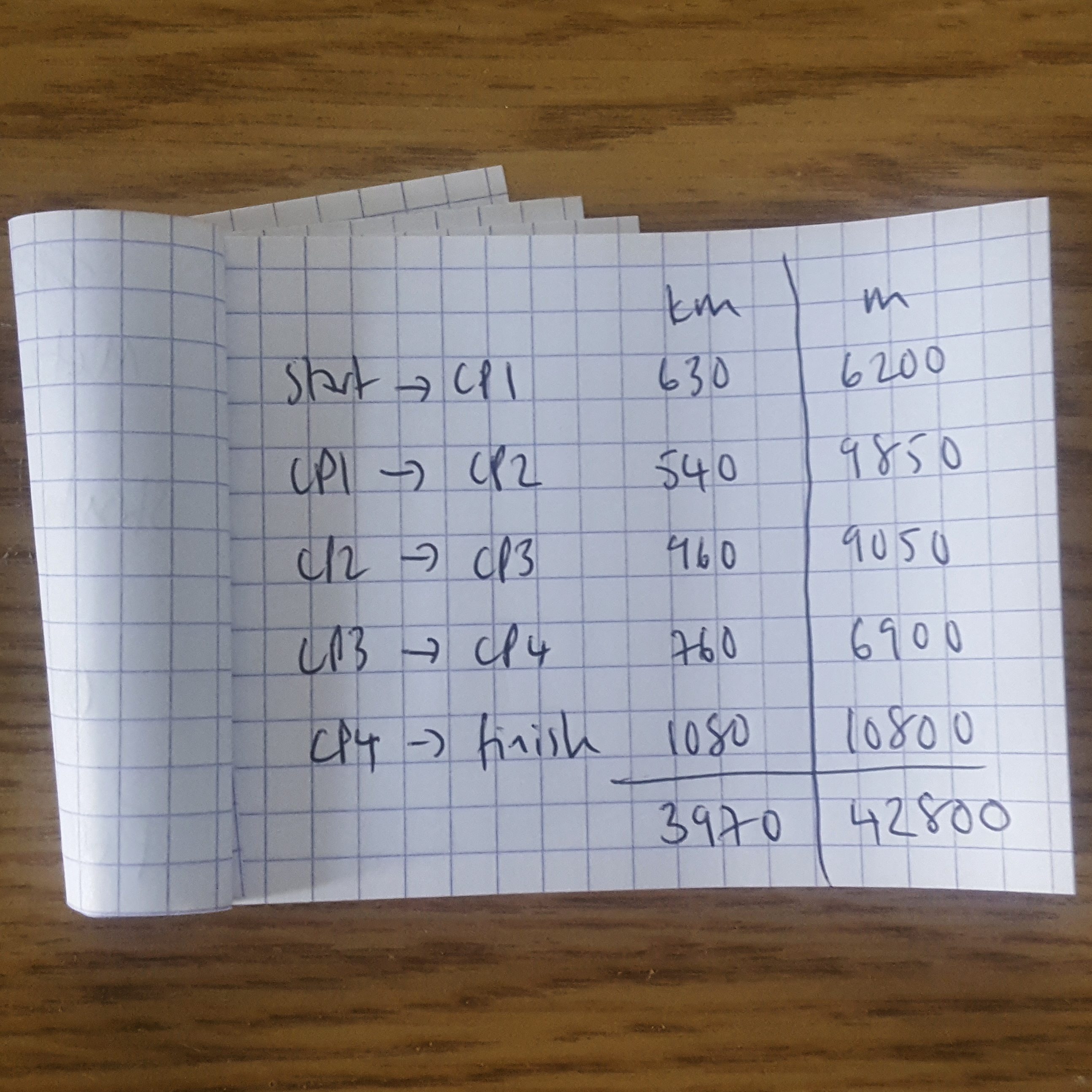
However no matter how much looking at maps and photos I do riding 4000km in two weeks will be an entirely different experience. A line, some photos, a list of countries
Belgium
France
Germany
Austria
Italy
Austria (again)
Slovakia
Hungary
Romania
Bulgaria
Macedonia
Greece
and place names. It’s a flat one-dimensional world I’ve been looking at and it certainly won’t be that when we’re there. There again that corner of Hungary we’ll skedaddle across looks a bit flat.


Leave a comment