It must have been spring, as not only was the April TT ride the first proper full day ride of the year, it was also the first camping weekend of the year. A mate and his kids were coming along too so on Friday afternoon we jumped in their campervan/caravan combo and headed west. The campsite was just over the border into Dorset, in Wigbeth, not far from Cranborne. I was glad that I had a campervan to sleep in as the temperature dropped to zero overnight! However I awoke to sunshine and broken cloud so opted for arm and knee warmers, and a waterproof, rather than winter kit.
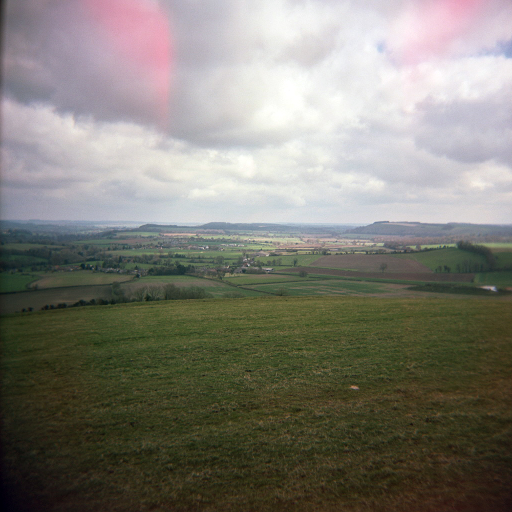
After breakfasting in the caravan, and arranging to meet my friends for lunch in Lulworth Cove, I hopped on bike and headed out of Horton. I slowly climbed gently rising and falling downland hills to the B3081, which would take me towards Shaftesbury. I was able to spin the big ring, maintaining cadence but my speed ebbing and flowing with the undulations. I crossed the border over into Wiltshire as the hills got tighter and valleys narrower, until I passed through Tollard Royal and started the climb over Cranborne Chase. Reaching the summit I was on the boundary of Wiltshire and Dorset, riding the ridge as if surfing a wave, the land dropping away on my right to the West Wiltshire Downs, and the Dorset Downs to my left.


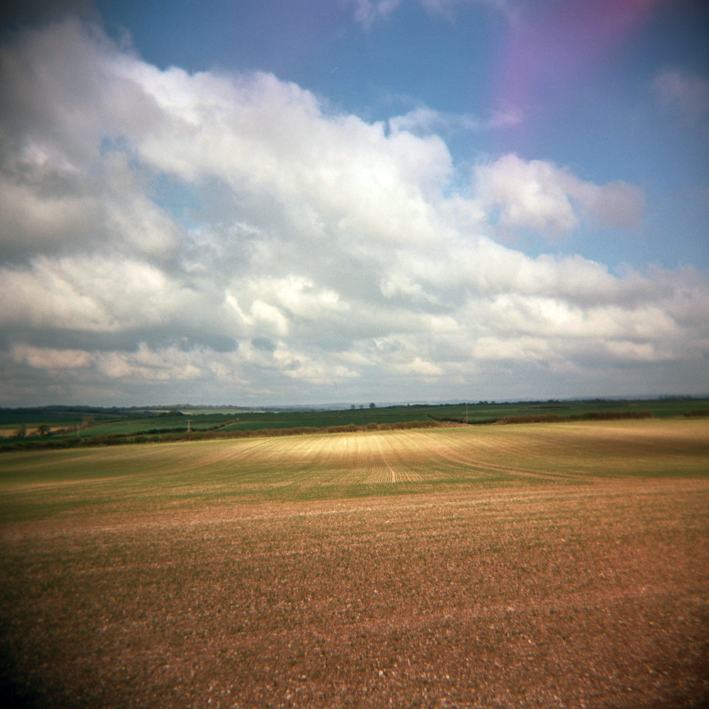
It was to my left that I turned after winding down Zig Zag Hill, for the long run down to the Jurassic coast. However first I needed to get up the 1:6 incline of Spread Eagle Hill. I had noticed in Dorset that roads signs used the old ‘one in something’ notation for hills rather than percentages, and also measured distances down to quarter miles. When road signs measure quarter miles you know that life can be taken a little slower. A quarter mile doesn’t mean anything speeding along in a car, but it means something on a bike or on foot. Another thing I noticed is Dorset is very green, Wales green rather than Sussex green, like it rains a lot.
Anyway I digress…over the top of Spread Eagle Hill and past Compton Abbas airfield, the road was a gentle decline for a good few miles meaning I could crank up the pace a little bit, to make up time for all the stops to take photos in the previous hour. North of Blandford Forum I turned right and headed for Durweston, and Winterborne Stickland beyond that. It was nice to finally be on smaller lanes, cycling is always best on roads with no road markings. If it’s yellow on an OS Explorer map then it’s probably worth riding. Most of the ride so far had been on orange roads on the OS map, minor B-roads, which were relatively empty but still some fast moving traffic. My scribbled route notes for the next 7-8 mile stretch simply said “follow river winterborne” so I was surprised to find that the River Winterborne was little more than a ditch (a picturesque ditch, but a ditch nonetheless), and often not visible from the road. However the place names along the way ensured I headed in the right direction, first to Winterborne Whitechurch, then Winterborne Kingston.

At Winterborne Kingston I missed a turning and ended up riding past a traffic jam on the A31 for a few hundred yards before passing through Bere Regis. Out of town up Rye Hill I then followed a long, straight, relatively boring, but fast section of road leading to Wool. However along this road there is 1) an army tank training camp, 2) a shooting range, 3) a small airfield, and last but by no means least, 4) Monkey World. A low budget disaster movie waiting to happen!
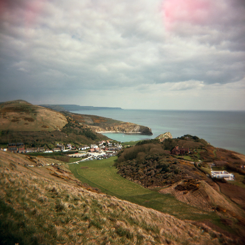
From Wool the road to Lulworth is a bit lumpy, up and down through farmland, before a fast descent to Lulworth Cove in time for lunch. Along the way my friends passed me in the campervan so I knew I must be keeping good time. I chucked my bike in the van, swapped cleats for trainers, pulled jeans over my lycra, and we retreated to the nearest pub for lunch.

 Back on the bike I started the second leg of the ride, back north to Horton via Corfe Castle. After a steady climb from Lulworth Cove it was past Lulworth Castle and through more army tank training land in a heavy rain shower and a strong headwind (unpleasant flashback to last month’s ride along Military Road). The landscape changed from heathland to dense woodland to open fields and hills as I neared Corfe Castle. The dark clouds passed and the sky turned clear blue again. The stretch of road between Creech and Corfe Castle with it’s tight hairpin up over Ridgeway Hill was lovely in the sunshine.


To avoid the A351 I took a bit of a looping detour across Middlebere Heath, where the landscape changed again, to wide open heathland covered in gorse with views of Corfe Castle silhoutted against the horizon. Rejoining the A351 near Wareham it started to rain again, so I just got my head down and rode as fast as I could to the junction a few miles up the road where I knew I would get off the main road again. It stopped raining as I passed through Organford and over the A352, and into Lytchett Matravers. I could see the sky darkening again and as I shot off down a lane out of town as another heavy rain shower started. It soon stopped as I whizzed along the narrow lane and ending up unexpectedly on the A350. Missed a turning again.
A short blast along the A350 and I was back on route as I turned off for Sturminster Marshall. Over the River Stour I rode along the flood plains, under clear blue sky again, to Wimborne Minster. From here it was a few miles through Furzehill and Holt back to Wigbeth through Horton. As I neared Horton dark black clouds passed overhead again so I upped my speed hoping I could race the clouds back to the campsite. I lost! As I entered Horton the heaviest hail shower I’ve experienced started. Massive hail stones bounced off the road, the bike, my helmet (interesting sound!) for a couple of minutes only, and then blue sky again. April showers.
No sign of my friends back at the campsite I checked my phone: “Your stuff is in caravan, it’s unlocked. We’re in the pub.” So I quickly got changed, and hopped back on bike for the half mile ride back up the road for dinner and a pint.
This ride reminded me (not that I needed reminding) why I love riding a bike. There’s something beautiful and enlightening about a day long ride over a long distance in Britain. The landscape changes so much, as can the weather, and you’re in it, feeling and smelling it all. One minute you’re riding in sunshine with a smile on your face, the next you’ve got your head down cursing the wind and rain water is dripping in your eyes. Every time your legs ache and you think about stopping you come across a gentle descent so you can freewheel for a bit. Or maybe I loved it because it was the first proper ride in sunshine and warmth since the year before. It feels decadent to ride out early morning and not get back until early evening, like you’ve wasted an entire day. Except we all know that riding a bike is never, ever, a waste of a day.
Strava link: http://app.strava.com/activities/50991915
Ride Stats:
Miles ridden: 92
Feet climbed: 5000
Average speed: 15.7 mph
Rain showers: 3
Local ale drunk: 1 x Badger Brewer’s Bee (lunch), 1 x Ringwood Best (post-ride)
Camera used: Holga 120
Film used: 2 x Kodak Portra 160

Leave a comment