There was much deliberation about this ride. Firstly I needed to work out if the Isle of Wight was part of Hampshire or not. If it was, then I’d be breaking one of the rules of the Tourist Trophy (only two neighbouring counties allowed, but this invokes a subrule that East and West Sussex count as one county). After some research it appears to be the Isle of Wight does count as it’s own county since the 1970s. Also the BBC weather website refers to “county of Isle of Wight”.
This led to the second set of deliberations due to the revolting weather that Britain enjoyed this spring. The south east was going to be wet and windy for the planned weekend of the ride. However I optomistically decided it would clear eastwards during the day, so if I left a bit later it would be half decent by the time I got to the island. The gamble paid off! It was hideous as I headed across West Sussex and Hampshire by trian, but by the time I got to Portsmouth I could see blue sky and shafts of sunlight.
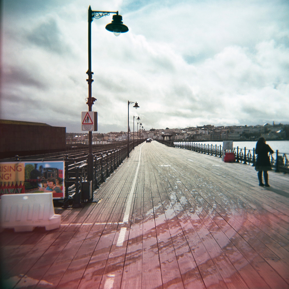
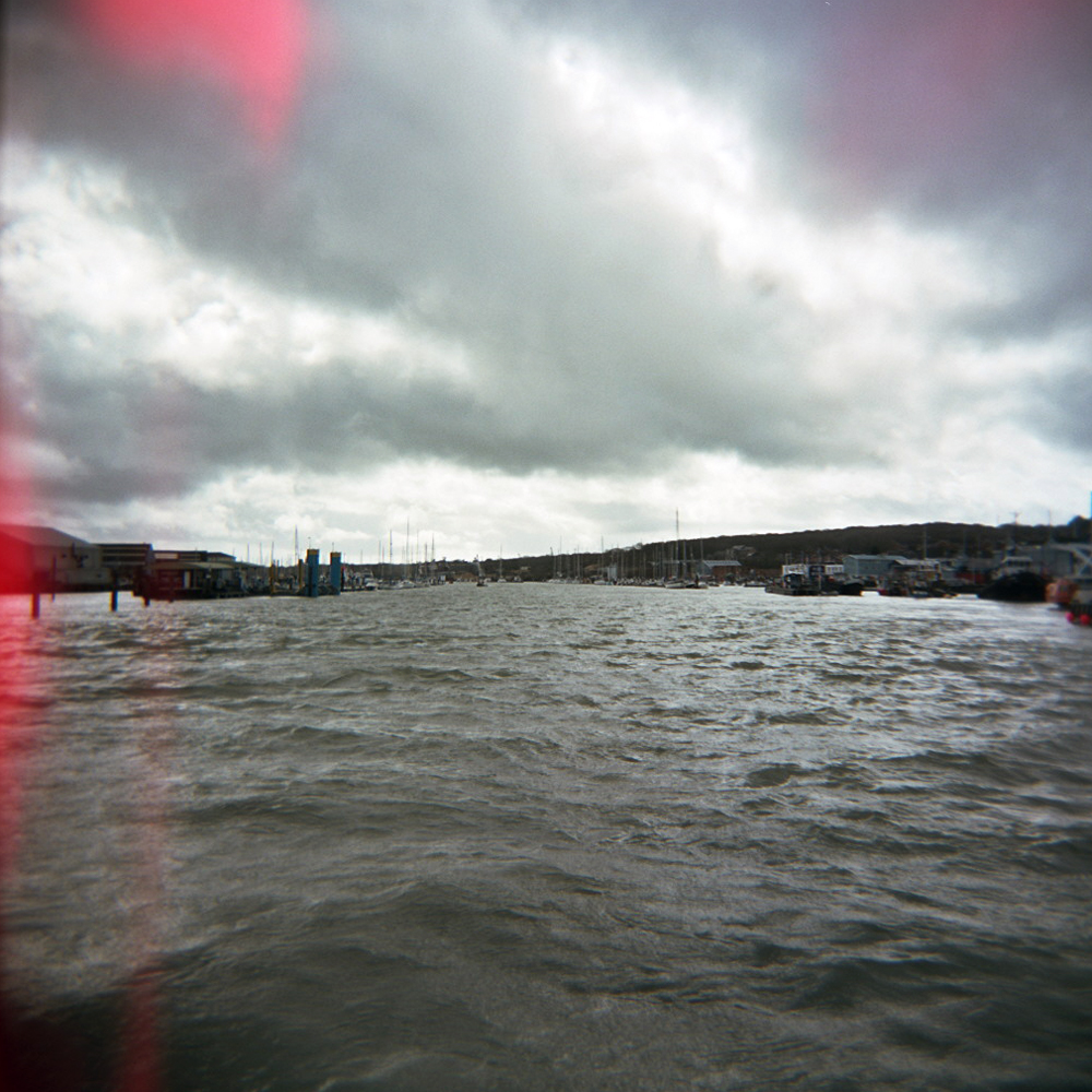
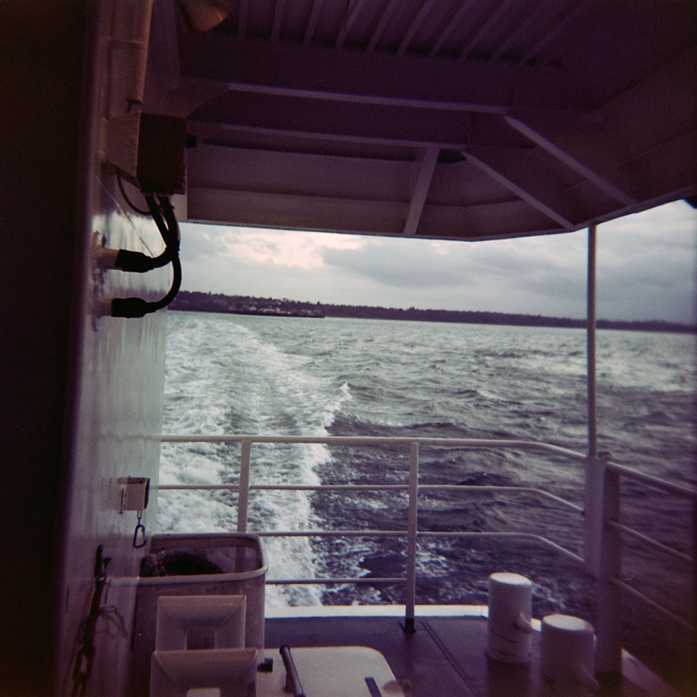
The ferry from Portsmouth arrived in Ryde (appropriately) where I disembarked into rays of sunshine bursting between the clouds. I clipped in and headed for the main road to Newport. Turning right for a short cut through a housing estate to catch the road to Cowes it started to absolutely dump it down with rain which was a bit concerning. However the shower finished as quick as it started, and that was the last of the rain that I saw all day. As I popped out onto the Cowes road I spotted a sign with a bike overlaying the IoW graphic. Must be a bike friendly route into Cowes I guessed and darted off down the small lane. Two corners later I could see the River Medina down to my left as expected. At Cowes I had to clamber aboard my second ferry of the day, the Cowes – East Cowes chain ferry / floating bridge. Cleats and wet steel gangways really don’t go it was a tentative boarding with one had grasping my bike, the other the handrail. All of 2 minutes later I was back on the road, hugging the coast around Egypt Point heading for Gurnard Bay.

There the road cut back inland and uphill. The next few miles were rolling, winding wet roads glistening sliver in the sunshine, though woodland and farmland, with occassional glimpes of the New Forest back on the mainland across the Solent. The road continued to roll up and down before a long gentle descent back to the coast at Yarmouth. Then it was back inland and rolling countryside until I hit the more built up area around Freshwater, and then arrived at the western tip of the island at The Needles.
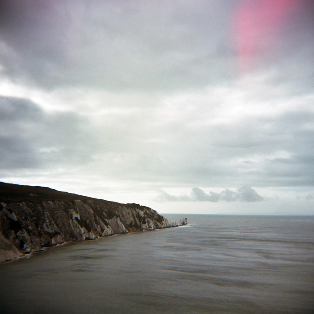
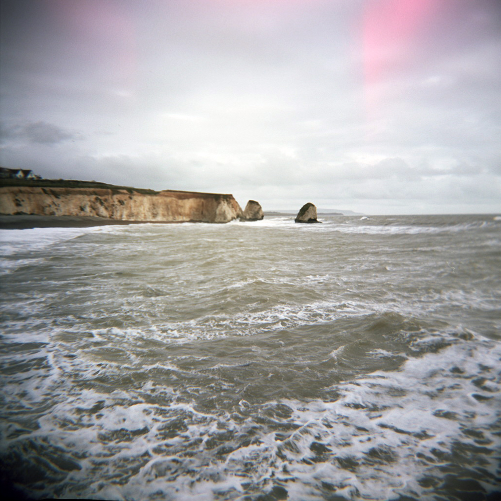
Turning around and retracing my wheel tracks half a mile back along the same road I forked right and headed for the south coast down a fast, narrow, high hedged descent into Freshwater Bay, where waves were crashing onto the beach. This was a sign of what was to come…
In my optomism I thought that even though I knew it would be windy, the prevailing wind would be south and south westerly all day. So a headwind on the relatively sheltered north side as I headed west, but a tail(ish)wind on the exposed south coast.
Nope. As I crested the hill out of Feshwater Bay and saw the south west coast stretch out in front of me I was hit by a wall of wind into my face, when I expected a helpful shove over my shoulder. To be fair I had been warned to fear the wind on Military Road.
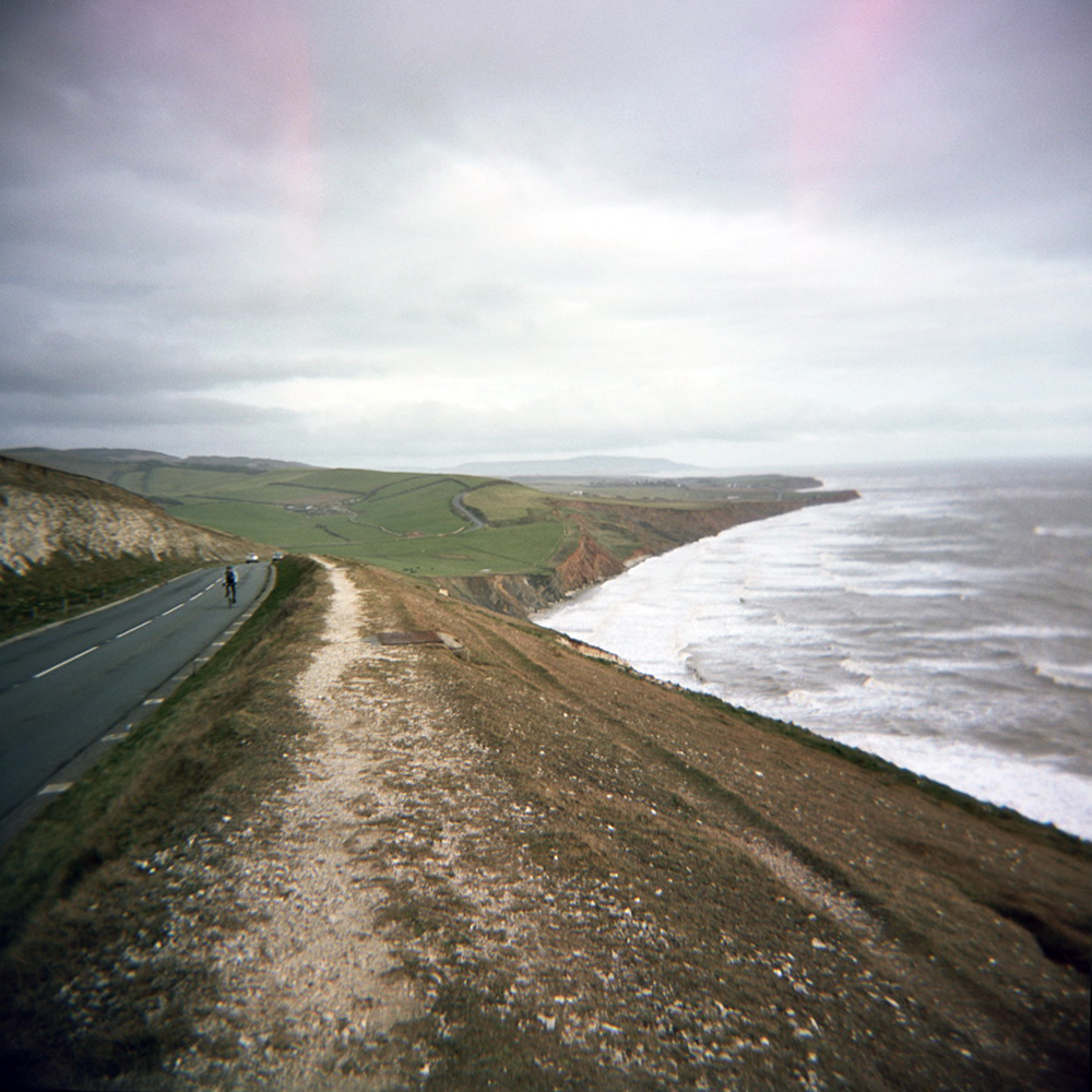

However I’d still rather forget the next 10 miles of so from here to the start of the climb up past Blank Gang Chine. It took the best part of an hour to cover 10 miles with the occassional obscenity screamed into the wind. And at one point even thinking “sod this, I’ll turn left and head back up to Newport and get the ferry home”. Of course cyclists are stubborn, pain loving idiots sometimes (most of the time) so I didn’t. I carried on. It wasn’t pretty. Pedalling squares doesn’t come close. Then I got to the sharpest, longest climb of the day. Awesome, just what I needed. As I slowly ground up past Black Gang Chine (I’d like to say spin, but it was definitely a grind) the thought of an energy saving descent down the other side kept me going. Idiot. As I topped out over the hill I was hit by another wall of wind. Great, I love pedalling down hills.
Despite the wind I managed to pick up quite a bit of speed in the run down into Niton. Unfortunately, due to a lumpy surfaced one way system and a junction, I couldn’t carry the momentum onto the next climb up through St. Lawrence. Then followed another long descent down to Ventnor, where I swung down a 25% zigzag road on to the seafront. When I originally planned this ride I intended to stop for a pub lunch in Ventnor and to sample a local ale, as seems to be becoming my Tourist Trophy tradition. However due to a late start because of the weather, the fact I was behind schedule due to the wind in the last 15 miles, I decided to crack on. I also realised that there was no way I was going to enjoy the 25% climb out of Ventnor on a full stomach.
As I (slowly) climbed up out of Ventnor towards Upper Bonchurch I realised that I really did need some sustenance of some kind. Just as this thought passed through my mind I spotted a tea gardens on the other side of the road. Time for tea and cake…
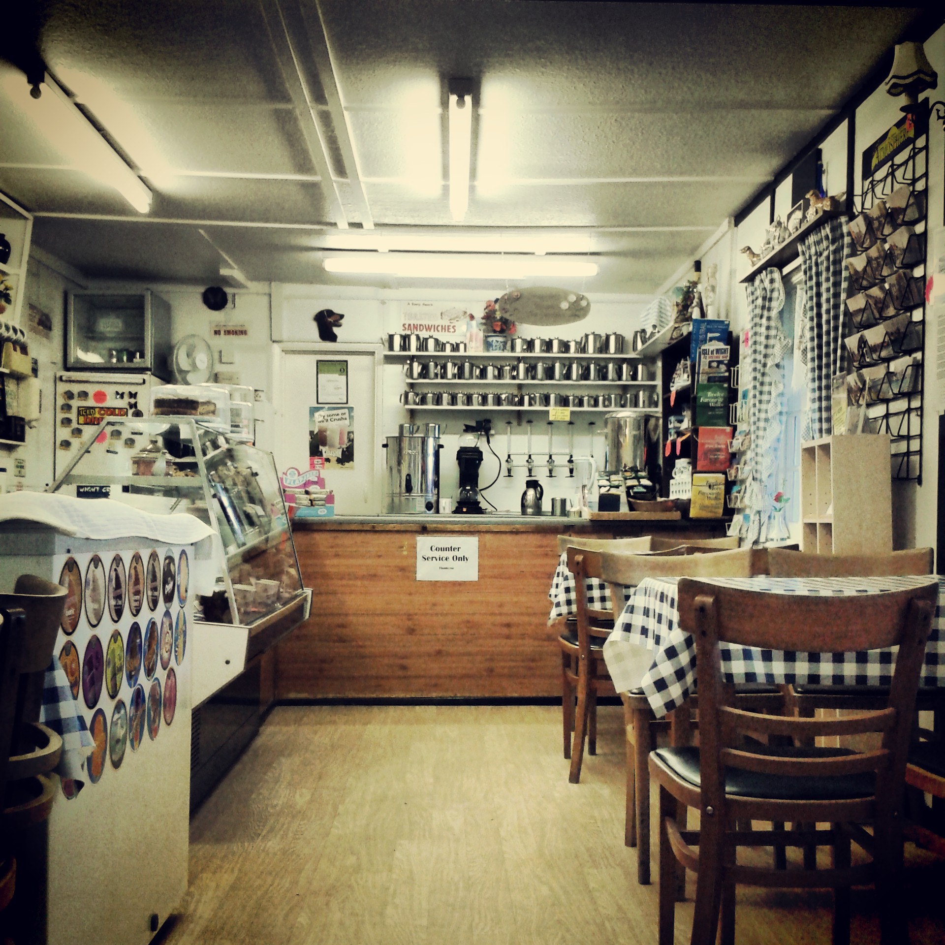
Ah, the restorative powers of tea and fruit cake! Back on the bike, heading uphill and still into the wind I felt like my legs were functioning again. The eastern side of the island is more populated than the western side so the towns started to come thick and fast. First Shanklin, which quickly gave way to Sandown. There was something slightly sinister and depressing about Sandown sea front, closed down amusements and hotels, and dirty white foam blowing off the sea over the promenade wall.
I followed the road as it turned away from the coast and over a hill, before rolling into Bembridge. I knew I was on the final stretch back to Ryde as I passed the house boats at Bembridge Bay.
It’s amazing how you forget your heavy, tired legs when you know you only have a few miles left. I suddenly found I had the power to sprint up the small hills puncheur style. OK, sprinting might be pushing it, but I wasn’t staring at the floor turning over my lowest gear any more. Joining the main road into Ryde I flew down the hill towards the sea and back to the ferry terminal. More by luck than judgement I arrived a few minutes before the next ferry was due. Even better there was one bottle of Isle of Wight ale left at the terminal cafe. As the ferry carried me back to the mainland I slumped in my chair, supped my ale, and forgot about the wind that hurt my legs for half the ride. Almost.
Strava link: http://www.strava.com/activities/44644347
Ride Stats:
Miles ridden: 65
Feet climbed: 4400
Average speed: 14 mph (stupid wind)
Slices of fruit cake consumed: 1
Pots of tea drunk: 1
Local ale drunk: 1 x Goddard’s Fuggle Dee Dum on the ferry home
Ferries taken: 3
Camera use: Holga 120
Film used: Kodak Portra 160

Leave a comment