In the early 1990s I spent three years at art school in Canterbury, living in Whitstable in my first year, so for February I decided to return to Kent and ride some roads and visit places I once knew. The ride would take me over the North Downs to the north coast of Kent, along marshland towards Faversham before heading south again and back over the North Downs. Much like a Sussex ride I would enjoy some lumpy hills, followed by a flat bit, and then more lumps. It’s a bit of a trek to ride all the way from Brighton to Whitstable and back, so I hopped on the train as far as Ashford. Off the train, a quick glance at the map, and I was off…
A short ride through the outskirts of town, over the M20, and straight into country lanes. Rather than having to keep referencing a map, I had scrawled route notes on pieces of paper stuffed in a jersey pocket. After a few miles I realised my instructions of ‘first left after Hinxhill’, ‘right at end of road’, ‘second left’, etc, were all very well, but assumed I’d get the first decision correct. I thought I had better reference a map, check a name on signpost, and hope they corresponded. Fortunately they did. According to my notes two more junctions and I would have a short, sharp climb to contend.
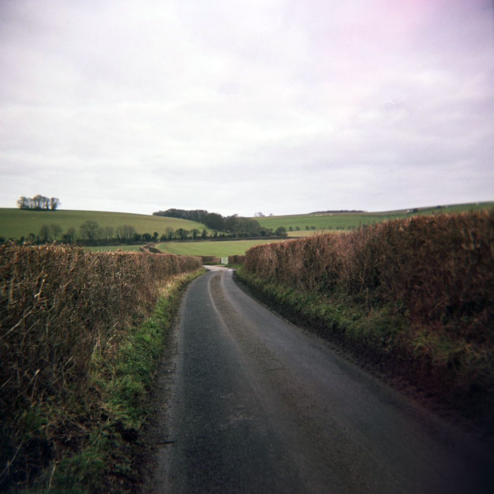
As I turned onto the hill, I passed a couple of horse riders who, after a quick hello, said “rather you than me”. Oh dear, that obviously meant the summit I thought I could see probably wasn’t. It wasn’t. As I turned a corner the road continued to rise until it crossed the North Downs Way. The view behind me stretched all the way over the Kent Weald and Romney Marsh. After a brief flat section to catch my breath, I whizzed down a long descent before a few miles of gentle, rolling hills and rough country lane tarmac, before another short climb over Chartham Downs.
From the top of the Downs I could see the Cathedral poking out above Canterbury. This clearly meant I was in for a few miles of freewheeling downhill into the outskirts of the city. Nearing Canterbury I started to recognise roads, passing shops and pubs I once frequented. A short ride through Wincheap (site of my second year abode) I crossed the ring road, onto cobbled streets and beyond the city walls. I zig zagged through the city heading for the cathedral thinking it a nice photo opp. However these days they now charge entry to the grounds of the cathedral.

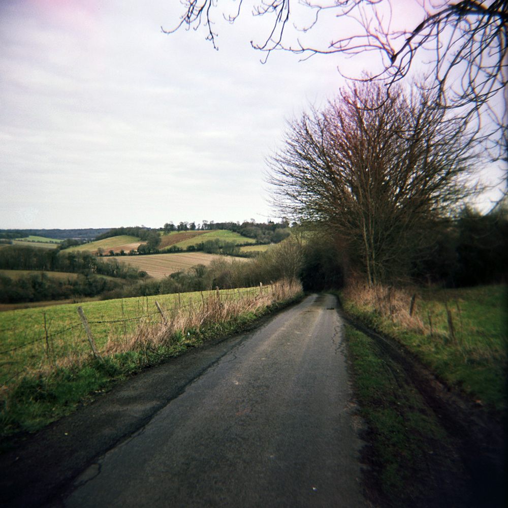
So, I took a photo of a gate and headed on through town, past a few pubs I frequented (a lot) as a student. Over the River Stour I passed the house I lived in in my final year, and started the climb up towards the University, where I attended many a gig, and Tyler’s Hill.
This road was part of my commute between Canterbury and Whitstable in the summer of ‘91, riding in the sun on a Marin Palisades listening to tapes of indie tunes on a Walkman. Rather than riding straight into Whitstable, this time I turned off towards Herne Bay, and descended by road through woodland I once rode around on the Marin at weekends. Exiting the woodland there was a short stretch across flat grassland, over the A2 and into the outskirts of Herne Bay.
Once into Herne Bay I caught my first view of the North Sea and dropped down onto the coastal path between Herne Bay and Whitstable. The rutted concrete of the coastal path wasn’t exactly skinny high pressure tyre friendly, as I vibrated past Swalecliff (passing the holiday park where my grandparents had a static caravan in the 60s & 70s) and Tankerton before stopping in Whitstable for lunch.

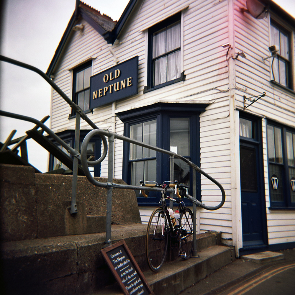
Whitstable was where I drifted away from road cycling and bought my first mountain bike. A red Trek 810, from Herbert’s Bikes on the High Street. It was nicked from the garden shed on the trip home. A Marin was bought in the sales with the insurance money. It was also the first place I lived by the sea, discovering the visual joy of a simple horizon line in one direction, apart from where the Isle of Sheppey breaks it. It’s probably no coincidence that for three years I predominantly made paintings which contained nothing but straight lines. The horizon from Whistable beach is no longer only broken by Sheppey, but also the new wind farm in the Thames Estuary, which I could just make out in the winter mist in the distance. I popped into The Old Neptune on the beach for lunch, and as I walked in Syd era Pink Floyd was playing on the stereo. Pretty much the same as it did the last time I was here in the early ‘90s.

After lunch I rode west across Graveney Marshes towards Faversham, and then turned back south. This was the only part of route which wasn’t on the two maps I had, and the first time my notes let me down. I didn’t get lost as such, I knew which places on signposts I needed to get to, but didn’t necessarily get to them on the roads I planned. The roads also started to rise again at this point, climbing back up over the North Downs. There were a few miles of that annoying kind of stealth climbing – a flat looking road that makes your thighs ache despite not going as fast as you think you should be. There was a short blast along the A252 and A251 through Challock, before turning off, past Stour Art and dropping through King’s Wood towards Wye. Dropping through the trees the view suddenly opened up on the right and I could see how far I had to drop still. So head down and on the drops, I swept round corners, avoiding pot holes and oncoming cars.

At Wye I got caught at an old fashioned level crossing, where the man has to come out and manually open the gates for you. Once the train had passed it was a swift zip around the one way system, and onto the road towards Hinxhill again. Over the M20 and back into Ashford with time for a cuppa before the train home. Sat on the train, my legs ached, I watched the sun set over Romney Marsh, and the English Channel. A glorious end to a rather lovely day.
Strava link: http://app.strava.com/activities/41092136
Stats:
Miles ridden: 60
Feet climbed: 2600
Average speed: 15 mph
Local ales consumed: 1 x Shepherd Neame Kent’s Finest
Veggie burgers consumed: 1 (in honour of my art student years)
Camera used: Holga 120
Film used: Kodak Portra 160

Leave a comment