• Day 3 – A tale of two rides

    festive500boxing1As is tradition it’s time for the Boxing Day Century (imperial, not metric). I say tradition, but what I mean is I did it last year and I’m doing it again this year. Except last year I don’t think I quite managed 100 miles. Anyway, I’m up at the crack o’ sparrows and heading west as the moon is still suspended over the sea. As I ride into Steyning past the bottom of Bostal Road (not today thanks) the sun is rising over the South Downs, and on Spithandle Lane the low sun starts to catch the trees lining the lane. As I pull out of the end of the lane my back wheel whips about 2ft sideways and the front wheel slips too! Fortunately they both grip again and I stay upright. Somehow. A few metres later I realise that the back wheel is squirming around on black ice and I’m not convinced I have any control over the front wheel. Shit.

    festive500boxing2The next few miles through Ashington to Dragons Green are a bit dodge; I see tarmac twinkling in the low sun, and hear crackling below my wheels. I ride on whatever looks like the rougest bit of tarmac hoping for some grip. To make matters worse it’s also misty and I can’t feel my toes anymore. Fortunately it’s just the low weald that is icy and as I climb towards Southwater the roads defrost, and water starts to flow along gutters, and puddles splash rather than crack. Somehow I end up in Horsham, think I should have turned right at the end of that last lane. For the last few miles the sun has been filtering through mist and bare trees, and on Winterpick Lane sunlight is beautifully draped across the road.

    festive500boxing3At Slaugham I ignore my route notes and start to head north again to Handcross and Turners Hill. From here it’s through Balcombe (past the tea rooms, a Sussex cyclists’ favourite) and towards Ardingly Reservoir, which has flowed across the road. From here I consider heading towards the Ashdown Forest seeing as I hadn’t intended coming this way in the first place anyway. Then some sense kicks in. The hills in the forest are hard work and a midwinter century is not the time to tackle them. I turn south towards Lindfield so I can pick up my initial route again. From here it’s towards Lewes so I can get some flat kilometres out through Ripe to the Long Man of Wilmington. However I notice that my phone battery is draining fast in the cold, so decide to head back to Brighton via Ditchling Beacon (ouch) to re-charge it.

    festive500boxing4The plan is to then get back out and complete the century, however I am fully aware than once I’m back in a warm house it may be a struggle to leave again. Kettle on, cinnamon bagel in the toaster, Nutella out of the cupboard. It’s looking bad…

    An hour later I’m on Brighton seafront heading east towards Cuckmere Haven. This way I can still get to the Long Man and complete the route I originally planned, even if the latter part is backwards. As I crest the hill out of Seaford I can see Cuckmere Haven and Seven Sisters to the south, but to the north something doesn’t look right. Aren’t those fields down there?

    festive500boxing5All I can see is the valley floor covered with water with ducks, swans and geese swimming around. It turns out that the valley road to Wilmington is impassable so I have no choice to turn around.

    festive500boxing6I consider riding over High and Over into Alfriston but I’m guessing that will be submerged too, so I retrace my tracks along the coast chasing the setting sun. After a quick stop on Seaford seafront for some Christmas cake, I spin back past the tide mills and over the swingbridge at Newhaven. At Saltdean I decided I can’t be bothered with the cliffs again so drop onto the undercliff path back to Brighton and home. Again. One hundred miles completed, even if not quite how I planned.

    festive500boxing7http://www.strava.com/activities/101974182
    http://www.strava.com/activities/102019054

    162km ridden. Total so far 272km.

    Day 4

    Wind. Rain. Aching legs. Rest day. Anyway it’s that other Festive 500 tradition tomorrow, Velomorpha‘s White Chalk Hills Ultracross. Again when I say tradition I mean I did it last year, see here

  • Pre

    The weather forecast for the next week looks well iffy so I’m in two minds whether to even start a Festive 500 attempt. I did also vow last year I wouldn’t do it again. However I really like the badge this year. The sensible way to do it would be to try and do daily rides of a decent distance: 500 km / 7 days (factoring out Christmas Day) = 71.43 km per day. However it looks like there are about 4 reasonable days between Christmas Eve and New Year, in between storms, strong winds and torrential rain. The only way to do it really is to cover as many kilometres as possible in the first few days and hope I don’t have to ride 150km in revolting weather on the last day. Obviously whilst thinking it’s not feasible there’s part of me that knows I’m going to give it a go. I also know that if it gets to day 8 and I’m 40km short I’ll go out and ride in whatever the weather throws at me (and judging by the forecast it could be chucking trees at me). I’m not hopeful.

    Day 1

    I wake up in the dark on Christmas Eve but I can’t hear wind or rain. Sounds promising! I peek through the curtains and the decision is made to ride to work, extending the commute as much as possible. I head over Devil’s Dyke under grey skies, before dropping into rain on the weald. It’s raining quite hard and I’m already going off the idea of the long ride, but it’s too late as I’m already heading in the wrong direction for work. The wind is over my shoulder so at least I’m getting shoved along. There’s a lot of standing water in the roads and bits of tree, and the occassional complete tree. At the top of Staves Wood Road I turn east for Hurstpierpoint and Ditchling, and into the back of Lewes for a loop around town to the office. Lots of wet clothes get hung over chairs and cupboards waiting for the ride home. Light plugged into laptop. 39km bagged.

    festive500xmaseve1Being Christmas Eve we get sent home early. I had been counting on this to allow a long commute home in daylight, and had been eyeing up blue sky outside for the last hour. I change back into dry clothes (except socks which are dried under the hand dryer in the disabled toilet). Once outside it starts to hammer it down with rain. Ace. Oh well, got to get home somehow. Fortunately it only lasts 20 minutes and skies are clearing eastwards so I am riding into sun. Oh, and then under grey again, but at least it’s not raining. The headwind isn’t as unpleasant as I was expecting so I’m heading west for Partridge Green. I can then turn south for Steyning and Shoreham as it should take me over 100km for the day. However the road through Shermanbury is under the River Adur which has consumed everything around it. Change of plan, I turn around and get to Steyning via Henfield and Bramber. I have to pick my lines carefully through Annington and Coombes as the lane is pretty mucky, lumpy and wet. Over the A27 and around the back of Shoreham Airport (no windsocks? Perhaps they blew away in the recent storms) it’s on to the coast road for a tailwind the rest of the way home. Another 59 kms completed.

    festive500xmaseve2http://www.strava.com/activities/101674943

    http://www.strava.com/activities/101731429

    Day 2

    Cheeky little spin down to Shoreham Harbour on way to friends for Christmas lunch, Disney films and Trivial Pursuit. A further 12kms (they all count, and I’m pretty sure they’re all going to be needed)

    festive500ride3http://www.strava.com/activities/101824592

  • For the final official Tourist Trophy ride of the year I came up with the idea to go “home” to Frimley and ride the hometown streets I bombed around on rattly-can sprayed single speeds, ‘racers’, and BMXs as a kid, and then the local Surrey, Hampshire and Berkshire roads that were my playground when I first got into road cycling. If you’re a regular reader you’ll know I’ve already bagged Surrey and Hampshire, but Berkshire means I’m still within the Tourist Trophy rules.

    IMG_20131214_190740Jumping off the train at North Camp I start off along the dirt track of the Blackwater River Path to Frimley, skinny tyres skidding around a bit, and having to pull leaves out of mudguards every now and again. After stopping on the high street to grab some well needed breakfast I was off to explore streets I’ve not ridden for about 20 years. Across the roundabout by Ye Olde White Hart [when did it acquire Ye Olde? Sure it was just The White Hart back then], up towards the church past Apex Drive [where Dad taught me to ride a bike without stabilisers], and off down Field Lane.

    IMG_20131214_192457Then it was past Lakeside Primary and Middle schools, Tomlins Pond [where did those houses on the far bank come from!?], and Tomlinscote School [never looked like that when I went there]. Past the Catholic School [where the hell did that come from!?] and turning right at the end of the road [road? that used to be a path] I headed off up towards Heatherside past the woods, Frimley Fuel Allotments, where there used to be a BMX track. Actually there were two, one down near the school field, and another at the top of the hill near the junction of Old Bisley Rd and Edgemoor Rd. In the late 80s I rode up the Old Bisley Road most weekends to my friend Alex’s house, before heading off for a training ride [he raced for Woking CC and then VC Meudon]. I spun through Heatherside and down to the roundabout over the M3 and towards Camberley, before turning back towards Frimley via the footbridge over the M3 again [the quickest way over the bridge is to pull massive skids around the 180 degree switchbacks. How none of us fell off this bridge and died is beyond me]. Past the house where the fella from Bros lived [think it was the drummer one] and up Longmeadow past another old house, through the Warren estate, and then darted down the alleyway [who put that fence there?] behind Latham Avenue and the back of another old house. Past Alphington Pond back on to Field Lane, round the back of the old primary school and out towards Frimley Green on St Catherines Rd [I remember when that was all fields down there]

    IMG_20131214_193241IMG_20131214_193528From here we’re into roads further afield and parts of old training rides. From Frimley Green it’s through Deepcut and along to Pirbright bends [still a lovely stretch of road to ride]. Under the railway bridge I turn right for the long climb [well, it felt like a big climb when I was 15] over towards Mytchett [there used to be a tiny magical bike shop here where an old man built wheels, shiny Campag parts glinted in the window, and where I bought my first cycling jersey – a black Castelli wool one with red and yellow striped side panels. It itched like hell]. At Mytchett lake I skip down the steps to the Basingstoke Canal towpath back towards Frimley Green. Rejoining the road I pass the Kings Head [when did it become a Harvester!?] and head for the Hatches, a bridleway past the old gravel pits and over the A331 [I remember when that was fields as well] and across the railway line at Farnborough North.

    IMG_20131214_193704I head out towards Berkshire through Hawley, across the A30, and through Frogmore and Darby Green. I bought a map for this ride as I thought I might need one, after all it’s been a long, long time since I’ve ridden out this way, but as I head out through Yately it all comes flooding back. I’m chasing my teenage self down the Reading Road, head down and pushing hard, sprinting for the village signs. Past the cricket green at Eversley Cross and onto Eversley I turn up Fleet Hill towards Finchampstead. Somewhere on this hill must be the border with Berkshire but it’s unmarked. Over the top of The Ridges I turn for Crowthorne and down Wellington Avenue, which isn’t as steep or as long a descent as I remember it. At the roundabout I turn north towards Wokingham to pick up Nine Mile Ride west towards Aborfield Garrison, Aborfield Cross and Swallowfield. To try and ride as many roads that I used regularly way back I loop back to Fleet Hill, but this time I turn off before the top down to Eversley Cross to retrace my wheel tracks for a mile or so. Forking left at Eversley I head for Bramshill for a few miles around the Forest of Eversley. Once out on a Sunday morning a young squaddie from Aldershot we passed near Fleet on a fixie asked if he could join us on our ride. We ended up out this way. I remember he thrashed us on every village road sign sprint, and then it would take us half a mile to catch him up as he wound down his pedalling [it ended up a long ride and he missed his lunch back at barracks].

    IMG_20131214_194148At the end of the Bramshill Road I aim for Hartley Wintney. The other way leads to Heckfield and I’m sure there used to be a 10 mile TT course down that way somewhere. I remember riding out that way one weekend and sitting on a grass verge by a roundabout watching low profile bikes with disk wheels one weekend. Also that way somewhere was the Happy Eater where we’d get toasted tea cakes in the winter. The road back to the A30 drops, rises, and then drops again, and today my legs were starting to feel a bit battered [I’d been out the night before, had less than 5 hours sleep, and eaten nothing more than a sausage roll and a biscuit all day. The younger version of me coped with this level of preparation far better than the current me]. I headed over the A30 towards Fleet but then turned back towards the A30 up a narrow lane. This was so I could get onto the road through Yateley Heath Wood, another road I’ve ridden hundreds of times in the past. In the old days we just rode the hill up the A30 out of Hartley Wintney towards Blackbushe airport. The A30 was much quieter in those days! The road through the woods is lined with rhododendrun and bracken. It summer it was an incredible, intense shade of green. In winter it’s deep green mixed with the orange-brown of the ferns. It stills smells the same as it did back then, but again the descent down to Fleet isn’t as long or as steep as I remember it.

    I’m now on the final stretch now, back towards the train. The roads round this part have changed a lot and I get lost round the back of Farnborough. Eventually I find my way into town past the leisure centre and library [there used to be a half pipe and ramps just here], and spin over the hill towards Farnborough North station. For two years I rode from Frimley across the Hatches, or along the Blackwater River, to this station, locked my bike up, and got the train to art school in Reigate [there’s a shoebox under the bed with sketchbooks that were filled on this trainline]. I sit on the platform and wait for the deisel train like I did all those years ago.

    Strava link: http://www.strava.com/activities/100141300

    Ride Stats
    Miles ridden: 65
    Feet climbed: 2200 (told you those hills were smaller than I remembered)
    Average speed: 15mph (the first 2 hours were done at average of 8mph so I must have caned it somewhere along the way)
    Old houses passed: 3
    Old schools passed: 3
    Things that are the same: Everything
    Things that have changed: Everything

    img423Thanks to Mum for the photo above

  • The sun is rising into an otherwise empty sky as I ride out of Wadebridge across the bridge over the River Camel. This hundred metres or so will be the first and last flat part of today’s ride. The only other flat section is the ferry across the River Fowey at the southern most point of the journey and I didn’t ride that bit. Anyway the River Fowey is fifty miles away yet. There’s a good deal of riding to do before I get there.

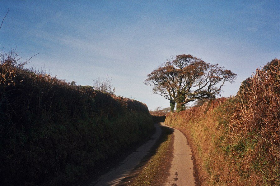
    First off I’ve got to get over the granite backbone of the county, across Bodmin Moor. Both rivers I cross today rise on the moor, before flowing in opposite directions; one north to the Atlantic, the other south into the English Channel, both carving twisting valleys into the softer shales that surround the granite. I head east, up country towards Davidstow, through St Mabyn to St Tudy and on to Tuckingmill. I lose count of how many times the road rises and falls between these villages, the road is either going straight up or sharply down. The lanes are covered in gravel, mud, leaves, and sticks making climbing and descending all the more… er, interesting. Every time I get out of the saddle the back wheel spins and slips. Downhill I have to pick my line really carefully and dare not touch the front brake, and because it’s too dangerous to whizz down the hills I have no momentum to carry into the next uphill. So it’s back out of the saddle and the wheel starts slipping again. And repeat. Again and again. The strength is slowly sapped from my legs. I’m almost starting to regret the 40 mile warm up ride along the north coast to Tintagel that I did yesterday.

    Autosave-File vom d-lab2/3 der AgfaPhoto GmbHSo far the ride has been through hedge lined farmland, and woodland, but the climb from Tuckingmill takes me over a cattlegrid (the first of many!) onto the moor. The trees thin and disappear, a vibrant carpet of green stretches ahead of me under the brilliant blue sky. The granite lumps of Rough Tor poke up from the moor ahead of me. Now I’m out of out of the sheltered lanes and up in the open the north westerly wind is hitting me head on. However I know that once I get across this stretch of the moor to Davidstow airfield I’ll turn south out of wind. As I turn south I also find that I’m heading downhill for a good few miles until I pass under the A30.

    Autosave-File vom d-lab2/3 der AgfaPhoto GmbH Autosave-File vom d-lab2/3 der AgfaPhoto GmbHAs soon as I’ve dipped under the A30 the road starts to climb again through North Hill and Henwood. The moor has a different character here. The lower lanes are again enclosed by high hedges, or ramp up through overhanging trees. As the landscape becomes more and more exposed the higher I get, but it’s more scrubby and scruffy here, there are small gnarly trees, crumbling moss covered stone walls and rocks. I wonder if all this climbing is playing tricks on me as some of the boulders appear to be moving. Then I realise they are grubby sheep grazing amongst the trees. Further on they just stand in the road and stare at me. I pass through Minions and the whole of south Cornwall spreads in front of me. I know the next few miles are predominantly downhill so I get my head down to make up some time.

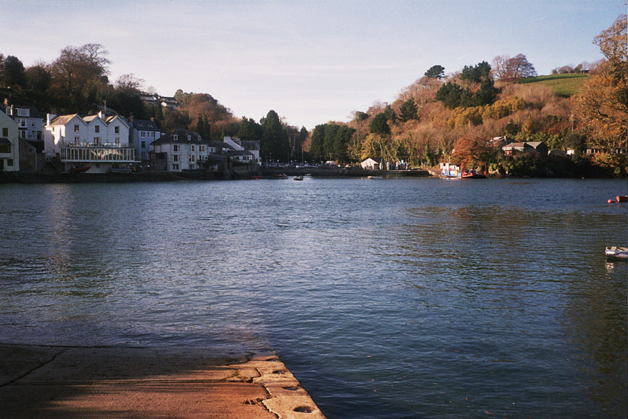
    Autosave-File vom d-lab2/3 der AgfaPhoto GmbH Autosave-File vom d-lab2/3 der AgfaPhoto GmbHCrossing over the A38 I head off my map, and my route notes turn out to be a bit too vague. “First left out of East Taphouse”. Turns out I meant the first left AFTER East Taphouse. As beautiful as the lane that is the first left turns out to be I’m not sure it’s the right road. It’s not, it goes to Herodsfoot and I’m supposed to be heading for Lerryn. Fortunately it’s a beautiful day, the sun is shining hard, and it’s the middle of the day so I know which way is south. So I follow the sun until I find a bigger road and signpost with a recognisable name on it – Looe. I know I don’t want to go here, but it’s in the right general direction, and hopefully somewhere I do want to go will be signposted off it. I’m also boosted by the fact I can see the sea and a lump of land sticking out into it that I am sure is Gribbin Head. It only takes a couple miles before I hit a junction with the road to the ferry across River Fowey. The next few miles gently roll down to the sea so again it’s head down to make up some time. At Bodinnick the ferry is across the the river. Time for a banana and a few minutes rest.

    Autosave-File vom d-lab2/3 der AgfaPhoto GmbHA few minutes later I roll off the ferry. And straight back into the hills. I loop around the village of Fowey before heading out towards Bodmin. Crossing over the A390 to Lanlivery Puddle and the Crift Downs, I hit yet more steep slippery ups and downs before passing under the A30 for the second time today. More climbing and more descending follows before the brief respite of a valley road along a tributary stream in to the Camel. The respite doesn’t last long. The next few miles are harder than I want them to be at this stage in the day. There’s a sharp climb out of Brocton, I’m out of the saddle pushing over a low gear as I emerge from the valley shadow back into the sun. After a wiggle along a narrow lane lined with high, high hedges I see a 28% sign. Fortunately it’s downhill. Actually I don’t mean fortunately, it’s bloody terrifying. It starts steep but then the road just seems to drop away. I stop and look down the hill and am not convinced I want to go down there. However it’s too steep to turn around and climb back up. There’s no way I can walk down in cleats either. So I shift fowards onto the top tube, grab both brakes until my hands hurt, unclip a foot which then hovers just above the tarmac, and I proceed as slowly as gravity will allow. I reach the bottom safely but can smell warm aluminum. I check to see if I have any brake pads left. (The general reaction from aunt, uncle and cousins when I get back is “You rode down there!!?”)

    I clip back in and start the final climb of the day, which fortunately isn’t as severe as what I just came down, but is steep enough to warrant a swear word or two. Once over this the last few miles are all downhill. The road is wide and bends shallow enough to see what’s coming so I scream back down into Wadebridge for a well earned cuppa and sarnie.

    Thanks to Auntie Val, Uncle Stu, Jo, Greg, Isla, Sam, Denny, John, Angie, Charlie and Alice.

    Strava link: http://www.strava.com/activities/97857320

    Ride Stats
    Miles ridden: 72.5
    Feet climbed: 5800
    Average speed: 12.1 mph (it was stupidly hilly & I took too many photos)
    Hills climbed: I lost count
    Ferries taken: 1
    Camera used: Olympus Trip 35
    Local ale consumed: St Austen Brewey Tribute, Sharpe’s Doom Bar

  • Tour of Britain

    Tour of Britain

    IMG_20131217_103407Back in January I read about a challenge that my friend Jo Burt posted on the road.cc website, the Tourist Trophy. The idea was simple – to go and ride in a different county each month in 2013. I read about this the day before I was due to ride to Surrey to visit friends so decided to give it a go…for the first month at least. A week later I was invited by milltag.cc to write about it for them. No turning back now, I was going to have to do it. This last weekend I completed the final ride.

    Each month hours were spent poring over unfurled maps, visualising contours and symbols in my head, looking for the smallest lanes across the most varied landscapes. I read about the history and geography of places, learned about the geology of the land that would be beneath my wheels, the wildlife I might see. I’ve discovered more of this beautiful country than I have ever before. I found places to which I’ll return and explore further. There are so many places there just wasn’t time to get to.

    Some rides were in places I vaguely knew or had seen from car windows. Others in places I’d never been. The last ride was around the place where I first rode a bicycle without stabilisers. There have been many circular rides, one around an island, another from one country to another and back again. There was a 2 day point to point ride which ended up longer than it should have been. I’ve ridden 1500 miles and climbed 110,000ft across 21 counties and 3 home countries, as far north as the snow tipped peaks of the Cairngorms, and to the east where the flat lands of East Anglia crumble into the sea. I didn’t make it as far west as Lands End but I did get to the birthplace of King Arthur. The most southern point was probably Fowey in Cornwall, but the wind on the south coast of the Isle of Wight actually felt like the ends of the world. And only two punctures. And both times in the rain.

    I’ve stayed with friends and family, slept in Youth Hostel dorms, and camped in the shadow of mountains and next to lakes. I’ve met up with old mates and made new friends. Varying rolls of film were shot, and many a word scribbled in a Moleskine. I’ve had pies and pints in pubs, cake in tea rooms, and eaten scotch eggs whilst sheltering in bus stops. At least five big bags of Jelly Babies have been consumed. One ride was alongside 5000 other riders, but most rides have been in happy solitude, and occasionally in absolute sodden loneliness. I’ve ground my way up, and swooped down, hills, followed rivers, circumnavigated an island, got lost, found myself again, then got lost again. I’ve gazed at the horizon across the North Sea, the English Channel and the Atlantic Ocean. Ferries have carried me and my bike across rivers.

    I almost gave up a couple of times. Actually these correlate precisely with the two times I had really cold, wet feet. Other times I would have happily ridden all day and all night. On one occasion I took a 25 mile detour just to ride in the sunshine for a bit longer. I screamed in joy and terror freewheeling down a mountain at over 50 miles per hour. I swore at the wind on a coastline and in a mountain valley, at the rain in the Mendips and the Peaks. Smiling in the sunshine far, far outnumbers those times. I’ve laughed and almost cried. Sometimes the landscape and the moment were so glorious I just had to stop in silent wonder.

    Thank you Jo, it was a brilliant, beautiful idea. It’s a shame it’s all over now…

    Or is it?

  • Coast

    A zig-zag route with a profile like saw teeth. Narrow lanes between high hedges, rough and twisting. Stick and stones, mud and leaves, over pitted tarmac. Gently turning into a corner the front wheel follows the tangential line until it finds some traction. Getting out of the saddle uphill is like roller training, back wheel spinning but no forwards motion. Back in the saddle to find some grip. Brightness out at sea. Clouds rush overhead, the sky turns blue and long strong shadows are cast. The gloves come off and arm warmers are rolled down. The wind is behind me, for now. Down to the water’s edge again, dropping through shadows back into the light. Sheep clinging to hillsides so as not to roll into the sea. Waves lapping on sand and rocks. Climbing in the shadow of tall hedges. Then down again, steep and fast, clutching onto brake levers. Past the harbour with turquoise water. Another steep climb followed by yet another steep descent. Another hairpin bend indicating yet more steepness around the corner. A brief respite along a ridge. To the south I can see clouds and the dark silhouette of Bodmin Moor looming, but that’s for tomorrow. Today it’s north and east, and back down to the sea again. Slope and gravity do their best to counter slowing and stopping. Slate cascades into the ocean. The sky has turned grey again, waves crash onto rocks. I can taste salt in the air. I turn to see the headland I need to get over. Back onto the small ring. Last climb. Wheel slips again, back in the saddle, thighs burning, lungs bursting. Past Merlin’s Cave and King Arthur’s Arms. Sit on a wall eating meat and potatoes wrapped in pastry. Protein, carbs and fat. It’s needed for the headwind home.

    IMG_20131129_140436 IMG_20131129_143935 IMG_20131129_150152 IMG_20131129_151234 IMG_20131129_152748 IMG_20131129_153126 IMG_20131129_153632 IMG_20131129_153839

  • I’m on Winnats Pass in Derbyshire. I’m lying on the wet grass verge looking at my bike lying half on the road, half on the grass with me. I gaze down the hill, then up the hill, and then forlornly back at the bike. A moment ago I was riding up the hill. The gradient and wind gradually conspired to push me over.

    IMG_4049There are days when riding a bike is sublime. Totally brilliant. Absorbed in your surroundings you become oblivious to the effort required to keep moving. The rhythm of pedalling is a simple pattern rather than exercise. You’ll happily ride all day, looking for unnecessary diversions, extra lanes and extra miles. Other days every pedal stroke seems a grind, lethargy seeping through every part of you. The physical and mental effort to push yourself forwards is an annoyance. On a good day the whirr of chain on cogs and the hum of tyres is faint background noise, somewhat comforting. On a bad day every click and creak is something about to break. Your chain is probably going to snap or rip your rear derailleur off.

    IMG_4027You don’t allow your thoughts to escape, to drift and flow. A single thought – I’m bloody hating this – twists around itself. The more you try to think yourself out of the situation the more you sink into it. Rather than riding into a joyful mood every turn of the wheels darkens your mood. An austere landscape is a thing of beauty when your mood is light, discrete details revealing themselves to you. In a foul mood it’s simply desolate. Bleakness abounds.

    IMG_4023When things are going well you ride through a landscape rather than riding across it. You feel within a place, part of the landscape as opposed to simply passing over its surface, separated from it. The road surface is smoother, the hills smaller and less steep. You are totally in the present, the immediacy of the moment and location are all that matter. You lose yourself in all the things hitting your senses. Nature around you reveals itself through sight, sounds and smells. Other times you really, really don’t want to be here and certainly not now. You desire to be elsewhere in another time. Preferably with a cup of tea or a pint.

    I climb back on and point the front wheel up the hill.

    Strava link http://www.strava.com/activities/91410843

    IMG_4056Ride Stats
    Miles ridden: 64
    Feet climbed: 5700
    Average speed: 12 mph
    Counties covered: Derbyshire, Staffordshire
    Number of times I wished I was somewhere else: Far, far too many.
    Camera used: Canon 500D

  • The long way round

    the long way roundShutting the front door whilst the nearly full moon still hangs over the city to the east I head west. The sun is yet to break cover. Where the sky meets the sea is pink and orange, a hint of what is imminent. I’ve got just under three hours before I need to be at my desk.

    Spinning along the cycle path over the cliffs to warm up my legs the sky lightens. I drop to the undercliff path to avoid an ascent over a cliff but I’m soon back up top when the path runs out. Over a headland, around the one-way system, over the swing bridge. Passing the tide mills the sun’s rays blind me and warm me in equal measure. The sea is close to my right hand side and another headland ahead but no way over. Not on this bike anyway. I turn inland, into the houses.

    I rejoin the main coast road and as I roll over the brow of the hill the Cuckmere Meander is liquid gold flowing out to sea. Descending to the bridge I realise it’s still water, no early morning alchemy. Over the bridge I turn up the valley. The flood plain is in the shadow of the downs on my right, the hillsides opposite bounce sunbeams back into my eyes. The reeds are leaning towards me in the wind. My back wheel skids and skips a little on the rough surface when I get out of the saddle as the roads weaves and undulates.

    At Chapel Hill rays of golden light glance off gentle curves, the depths of the coombes cast dark blue-purple. Over the top of the hill and it’s that view again. In the shadow of Windover Hill I let me eye wander around the downland and weald for a moment. The whole of Sussex is merely a green strip between shadow and morning light. Down at the Long Man a middle-aged gent appears from the hedgerow clutching 3 rabbits. We exchange cheery hellos, but whether a farmer or a poacher I have no idea.

    Down on the flat the wind makes it feel uphill. The lanes don’t meander and curve here, they zig and zag around right angled corners. I’m on the drops and my head is down, trying to push through the wind. My legs are burning, but it’s not the cold now, it’s exertion. As Mount Cabon and the Glyndebourne wind turbine gradually get closer I know I’m nearing my destination.

    I sit at my desk and turn my computer on, a dull ache echoes through my legs under the desk. I look at the blue sky and hills outside the window.

  • Look left you’ll see probably my favourite view in Sussex. I never tire of the view west. It’s up against some stiff competition – Steyning Bowl, the Weald when you look out from the false summit on Ditchling Beacon, the view north from just below the summit of Firle Bostal, the Seven Sisters from Seaford Head, the Cuckmere Meander from pretty much anywhere, amongst others – and all from up hills. It’s the main reason for riding up them. That and to justify cake at your preferred cafe stop.

    However Chapel Hill isn’t a big hill, and this isn’t the widest vista you’ll find in Sussex, but the scale is perfect, wide enough to see for miles and miles, but small enough to know your way around it. Aesthetically I can’t, or more honestly, won’t fault it. The way the pattern of lines flow down the fields to the River Cuckmere, drawing your eye into the view. Whatever the colour and texture of these fields, it seeps into the fields across the river and into the distance. The fact the South Downs always look best in profile, all undulating soft ripples along the escarpment; sometimes shrouded in mist, other times cloud shadows scuttling up and over, and occasionally the sky is empty but for the sun casting shadows along the ridge. You can see Bostal Hill, Bopeep chalk pit, the distinctive curve of Firle Beacon, the wind turbine at Glyndebourne, and Mount Cabon. Beyond that is home. On a clear day you can see across the weald, past Arlington Reservoir, all the way to the North Downs to the north west.

    A swig of water and clipping back into my pedals, I’ll roll down the road to Wilmington to say hello to the Long Man.

    The health of the eye seems to demand a horizon. We are never tired, so long as we can see far enough.

    Ralph Waldo Emerson, Nature. 1836

    IMG_20120605_194253 IMG_20130629_151412 IMG_20130505_131345 IMG_20130826_134133 IMG_20131116_151529IMG_20131119_111336IMG_20131229_195134

    IMG_20140202_165509

  • The YHA weren’t lying when they said the Wye Valley hostel was at the end of a “a steep unsurfaced road with a hairpin bend”. The first few hundred metres of the September TT ride was back up that steep driveway more suited to a ‘crosser or MTB. The hostel lies next to the River Wye which was shrouded in mist as I left, but directly above my head was blue sky. I was optimistic about the weather despite the fact I was heading to the Black Mountains in Wales. I’ve been to the Black Mountains quite a few times before for the Green Man Festival, and I’ve only ever not been rained on at one of them. And for two of them it was unbelievably sodden.

    Heading west and over the Wye the first climb of the day (the first of many) was over Symonds Yat Rock towards Monmouth via the Forest of Dean. On the long sweeping descent back down towards the Wye at Monmouth I passed over a double border; Gloucestershire into Monmouthshire, England into Wales. At Monmouth I stopped for breakfast and to check my route notes against the map.

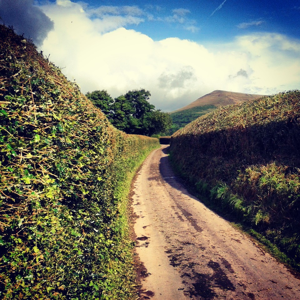
    IMG_20130914_092028After a pot of tea and bacon sarnie I continued west towards Abergavenny on narrow lanes that rose and fell with regularity. In the distance I could see the Black Mountains, the edge facing me looking like the escarpment edge of the South Downs, but far more menacing. Not helped by the fact the mountain peaks beyond did indeed look black. In contrast the landscape around me was lush green (all that rain) and empty fields the hue of burnt sienna oil paint. Passing a farmhouse a couple of dogs snapped and barked at my cleats, patriotic hounds that could smell English blood?

    IMG_20130914_204003Looping back and forth over the A40 and over a hill I was soon passing through Abergavenny and on my way to Crickhowell, crossing another double border into Powys and the Brecon Beacons National Park. Across the River Usk at Crickhowell I passed the Glanusk Estate, home to the Green Man Festival, and towards the first proper hills of the day: The Black Mountains.

    River Usk at Crickhowell
    River Usk at Crickhowell

    The Black Mountains are the eastern most edge of the Brecon Beacons, a set of ridges separated from the rest of the Beacons by the Wye Valley and straddling the border of Wales and England. These lumps of sedimentary rock – sandstones, mudstones, siltstones – were to be my playground for the next couple of hours.

    IMG_20130914_191515After passing back over the River Usk and then the A40 I started the climb towards the pass between Mynydd Llangorse and Mynydd Troed. I headed towards the town of Llangors before turning onto a narrow lane lined with high hedges, framing Mynydd Troed ahead of me.

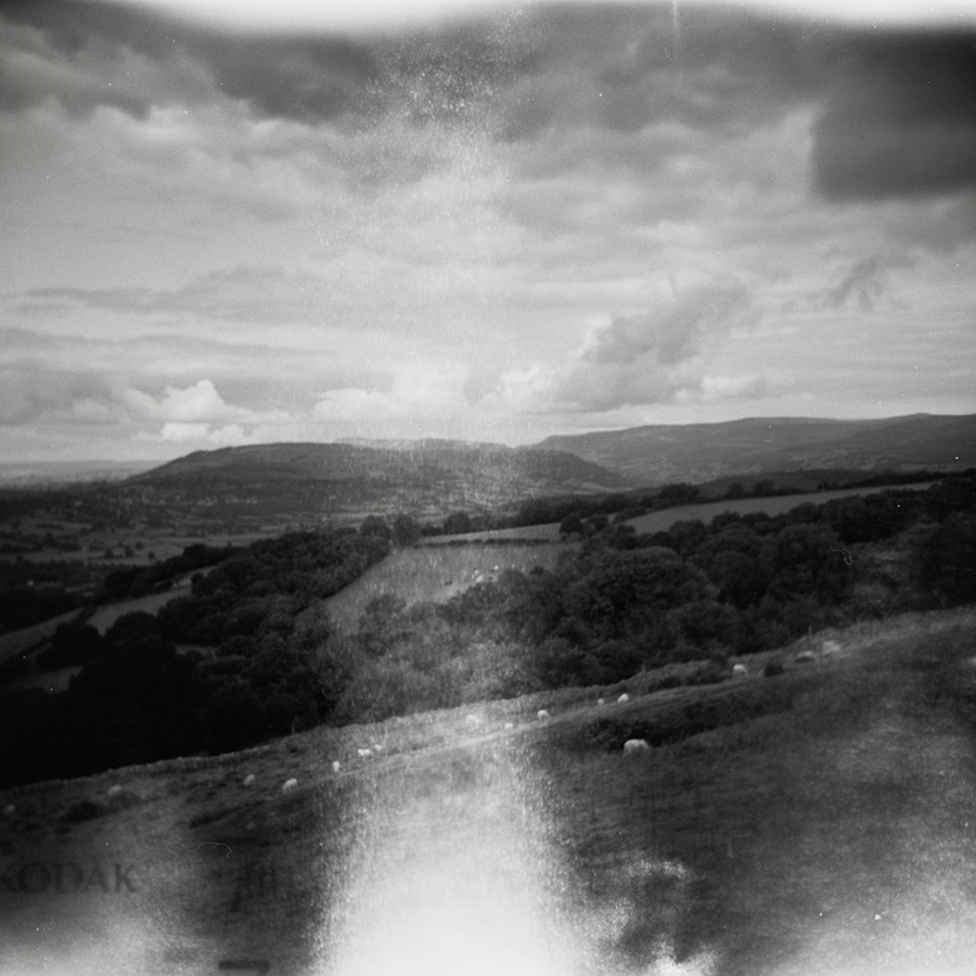
    IMG_20130914_190728The lane got narrower and steeper, the pain in my legs greater with each pedal stroke. Then rounding a corner I was at top. I glanced behind me and then had to stop to take in the vista. Down below was Langors Lake and the Brecon Beacons rising into the distance. The last mile or so had hurt but the tops of hills are fine places to arrive at.

    IMG_20130914_180941 IMG_20130914_190142The view to the east was as good, and even better I had a good few miles of freewheeling back down to the Usk valley. Back over the river and I started the climb up Mynydd Llangynidr, an undulating plateau of yet more sandstone and limestone. However it was now the mountains’ turn to play with me. I’ve driven over this mountain before so I knew it was a long climb and the road over the top could be bleak depending on the weather. It wasn’t long before I realised that I hadn’t been refueling enough and had that ominous pre-bonk feeling. This wasn’t helped by the cloud that was rolling over the high moorland and the resultant drop in temperature and dampness hanging in the air. I stuffed jelly babies in my mouth, followed by a banana, which helped, but then as I looked down I saw “3km to top” written on the tarmac, which didn’t. However I did know that I would be turning back for Crickhowell before the top so maybe I only had 2.5km to go. That thought didn’t help me. I crawled over the first summit and the road started to descend offering some respite, and I could see I would be turning off before it started to climb again. I also know I would be stopping in Crickhowell for lunch. I shifted back onto the big ring, got my head down and hoped there would be no sheep in the road on the fast descent…

    Autosave-File vom d-lab2/3 der AgfaPhoto GmbHIt is a really bad idea to order lunch just after you’ve nearly bonked. You order comfort food and way too much of it. In this instance burger, chips, onion rings, cup of tea. You know, the food that the pros eat. Then you eat it way too fast. Which leads to the weird feeling of still feeling weak, but stuffed and a little ill. Oh, and then a 1 mile 9% climb out of Crickhowell.

    The next 20 miles undulated through stunning countryside, dropping me into little wooded valleys and back up onto high ground, then over the Hereford road I climbed Campston Hill. The view from here was incredible, the edge of the Black Mountains disappeared to the north, the route of Offa’s Dyke, and to the south and east England spread before me as far as the Cotswolds. It was breathtaking and took my mind of the ache in my legs. Almost.

    At Tregate Bridge I crossed the River Monmow and Herefordshire border back into England, three borders; one natural, and two linear borders printed on a map. The road started to immediately climb hitting 20% at times. I really didn’t need this now. I was out of the saddle and staring at the floor. There was a stern inner monologue. Some bad language was used. My legs really hurt but I knew I was only 10 miles from the hostel. I just had to get over this last climb and it was all downhill to the finish…

    Except for the sharp climb back over the hill from Goodrich to the hostel. And the clattering down the “steep unsurfaced” track to the hostel didn’t do my aching calf muscles and arms any favours. I leant my bike against the door frame of the hostel, ordered dinner, bought a beer and headed for the shower.

    This was probably the hardest but also most beautiful TT ride so far, as Jo* would say “no scruffy bits.” And that is saying something as Scotland, the Lakes, and France were all pretty spectacular, and Somerset, Dorset, Suffolk and Norfolk all had their moments. One day I’ll go back for a few days touring around the whole of the Brecon Beacons. I’ll just remember to eat more often.

    * Jo Burt, instigator of the road.cc Tourist Trophy

    Strava link: http://www.strava.com/activities/82402143

    Stats:

    Miles ridden: 100

    Feet climbed: 9000

    Average speed: 13mph

    Near bonks: 1

    Ill thought through lunches consumed: 1

    Counties: 4 (Herefordshire, Gloucestershire, Monmouthshire, Powys)

    Countries: 2 (England, Wales)

    Local ale consumed: Kingstone Abbey Ale

    Cameras used: Holga 120 and Samsung Galaxy Ace/Instagram

    Film used: Kodak Tmax 100asa

    Autosave-File vom d-lab2/3 der AgfaPhoto GmbH